MyTopo
Wimberley Texas US Topo Map
Couldn't load pickup availability
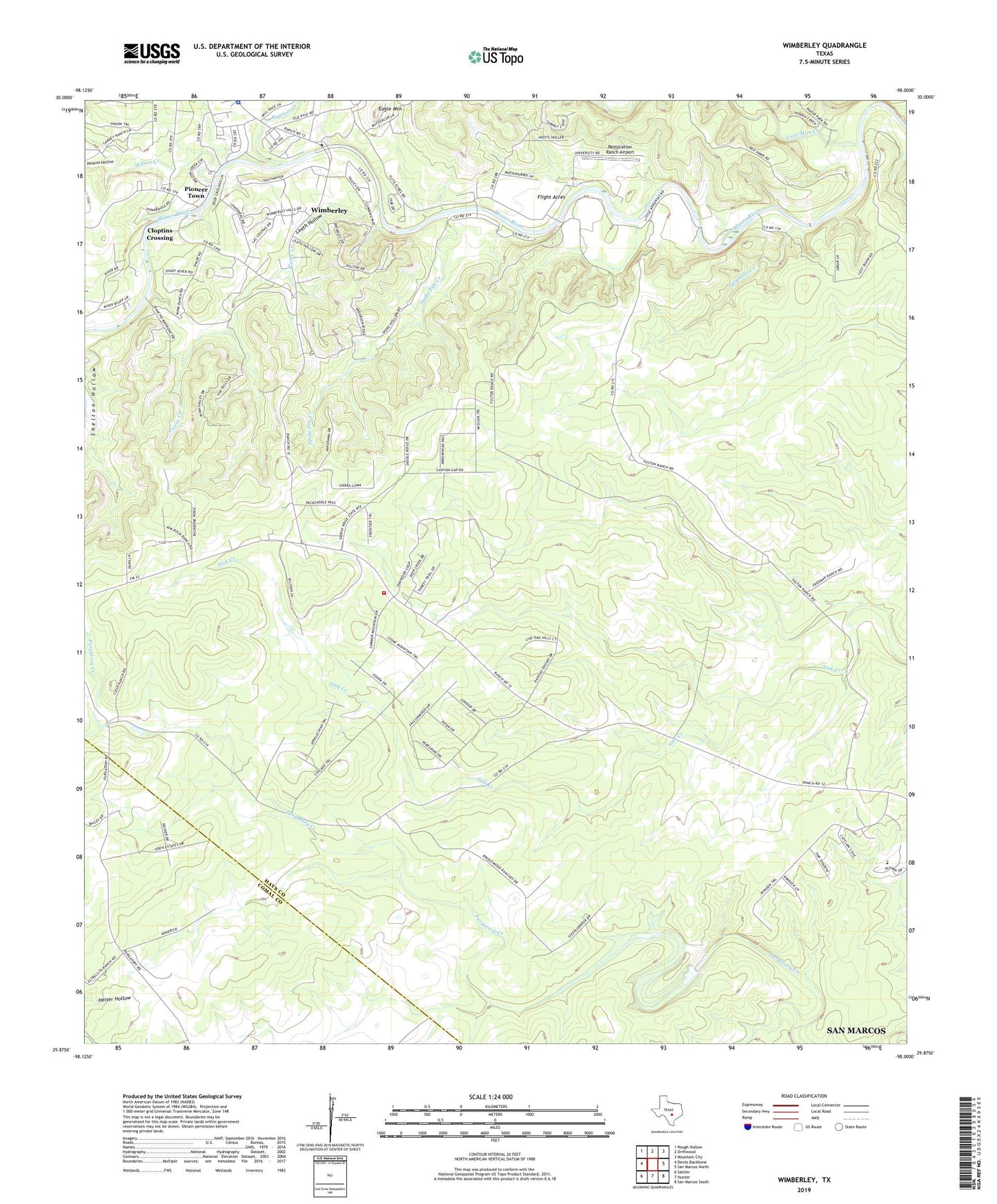
2019 topographic map quadrangle Wimberley in the state of Texas. Scale: 1:24000. Based on the newly updated USGS 7.5' US Topo map series, this map is in the following counties: Hays, Comal. The map contains contour data, water features, and other items you are used to seeing on USGS maps, but also has updated roads and other features. This is the next generation of topographic maps. Printed on high-quality waterproof paper with UV fade-resistant inks.
Quads adjacent to this one:
West: Devils Backbone
Northwest: Rough Hollow
North: Driftwood
Northeast: Mountain City
East: San Marcos North
Southeast: San Marcos South
South: Hunter
Southwest: Sattler
Contains the following named places: B Bar Ranch, Baptist Academy San Marocs Football Field, City of Wimberley, Cloptins Crossing, Cowan Ranch, Cypress Creek, Eagle Mountain, Flight Acres, Freeman Ranch, Fulton Ranch, Hays County Constable's Office Precinct 3, Hays County Sheriff's Office Wimberley - Junction Substation, Heaton Hollow, Houston Boys Camp, John R Dobie House, Leath Hollow, Lone Man Creek, Pierce Creek, Pioneer Town, Restoration Ranch Airport, Scrutchin Ranch, South Hays Fire Department Station 12, Spoke Pile Creek, Sycamore Creek, Trinity Chapel Church, Williams Ranch, Wilson Creek, Wimberley, Wimberley City Hall, Wimberley Emergency Medical Service Systems, Winn Ranch, Winn Ranch Airport