MyTopo
Devils Backbone Texas US Topo Map
Couldn't load pickup availability
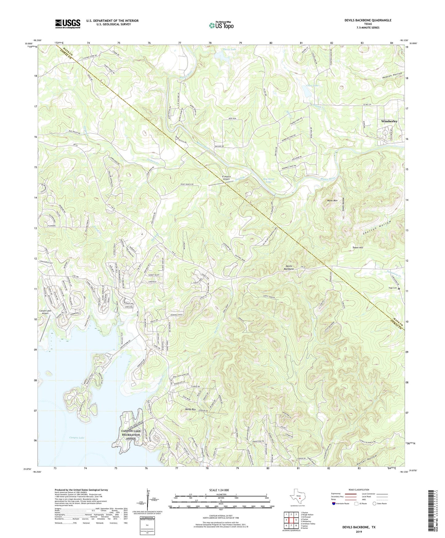
2022 topographic map quadrangle Devils Backbone in the state of Texas. Scale: 1:24000. Based on the newly updated USGS 7.5' US Topo map series, this map is in the following counties: Comal, Hays. The map contains contour data, water features, and other items you are used to seeing on USGS maps, but also has updated roads and other features. This is the next generation of topographic maps. Printed on high-quality waterproof paper with UV fade-resistant inks.
Quads adjacent to this one:
West: Fischer
Northwest: Payton
North: Rough Hollow
Northeast: Driftwood
East: Wimberley
Southeast: Hunter
South: Sattler
Southwest: Smithson Valley
This map covers the same area as the classic USGS quad with code o29098h2.
Contains the following named places: 4 S Ranch Airport, 78133, 78623, Baldy Mountain, Boy Scout Dam, Boy Scout Lake, Canyon Lake Airport, Canyon Park, Carpers Creek, Clear Lake, Clear Lake Dam, Devils Backbone, Dutch Branch, El Rancho Cima, Elm Creek, Fort Sam Houston Recreation Area at Canyon Lake, Hugo Cemetery, Jacobs Creek, Jacobs Creek Park, Moon Mountain, Old Hancock Trail, Pierce Dam, Pierce Lake, Pinoak Creek, Rancho Del Lago Heliport, Randolph Recreation Area at Canyon Lake, Shelton Hollow, Smith Hollow, Sorrel Creek, Tower Hill