MyTopo
Hunter Texas US Topo Map
Couldn't load pickup availability
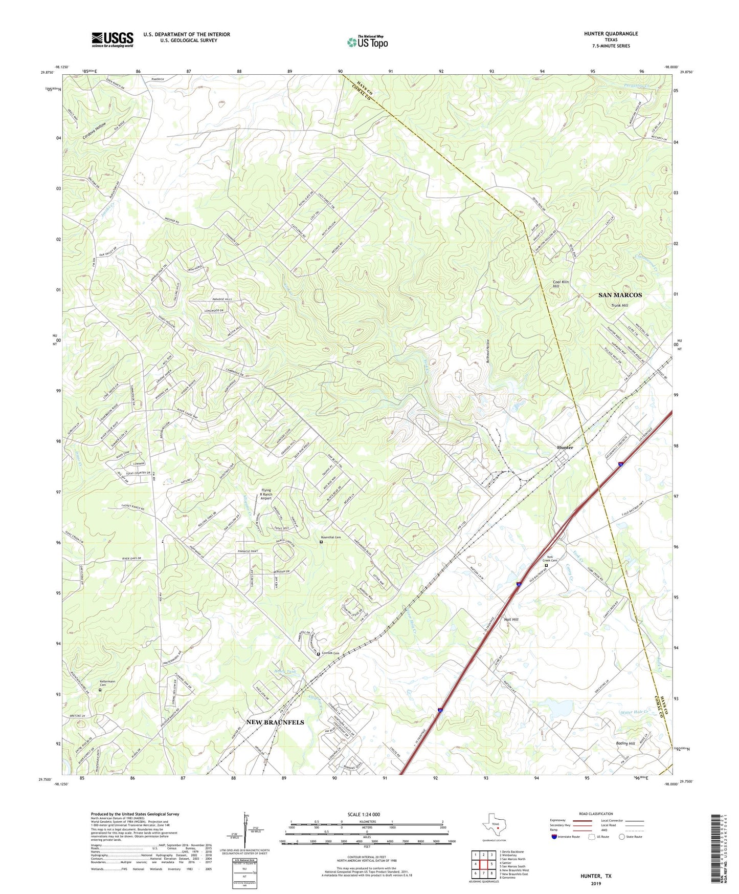
2022 topographic map quadrangle Hunter in the state of Texas. Scale: 1:24000. Based on the newly updated USGS 7.5' US Topo map series, this map is in the following counties: Comal, Hays, Guadalupe. The map contains contour data, water features, and other items you are used to seeing on USGS maps, but also has updated roads and other features. This is the next generation of topographic maps. Printed on high-quality waterproof paper with UV fade-resistant inks.
Quads adjacent to this one:
West: Sattler
Northwest: Devils Backbone
North: Wimberley
Northeast: San Marcos North
East: San Marcos South
Southeast: Geronimo
South: New Braunfels East
Southwest: New Braunfels West
This map covers the same area as the classic USGS quad with code o29098g1.
Contains the following named places: Bading Hill, Bullhead Hollow, Caney Creek, Circle Dot Ranch, Coal Kiln Hill, Conrads Cemetery, Flying R Ranch Airport, Haley Tank, Hunter, Kellermann Cemetery, Nail Hill, Rosenthal Cemetery, Royal Forest, Soil Conservation Service Site 1 Dam, Soil Conservation Service Site 1 Reservoir, Soil Conservation Service Site 2 Dam, Soil Conservation Service Site 2 Reservoir, Soil Conservation Service Site 3 Dam, Soil Conservation Service Site 3 Reservoir, Trunk Hill, Wegner Ranch, York Creek Cemetery