MyTopo
Mountain City Texas US Topo Map
Couldn't load pickup availability
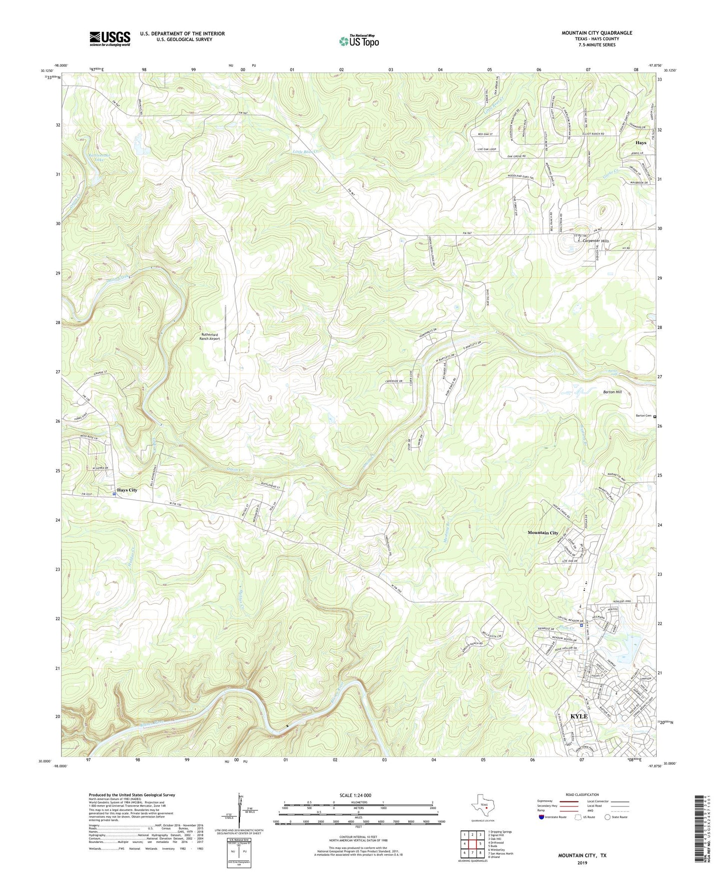
2022 topographic map quadrangle Mountain City in the state of Texas. Scale: 1:24000. Based on the newly updated USGS 7.5' US Topo map series, this map is in the following counties: Hays. The map contains contour data, water features, and other items you are used to seeing on USGS maps, but also has updated roads and other features. This is the next generation of topographic maps. Printed on high-quality waterproof paper with UV fade-resistant inks.
Quads adjacent to this one:
West: Driftwood
Northwest: Dripping Springs
North: Signal Hill
Northeast: Oak Hill
East: Buda
Southeast: Uhland
South: San Marcos North
Southwest: Wimberley
This map covers the same area as the classic USGS quad with code o30097a8.
Contains the following named places: Barber Falls, Barton Hill, Bob Shelton Stadium, Brown Ranch Dam, Carpenter Hills, City of Mountain City, Dahlstrom Intermediate School, Farris Ranch, Flatrock Ford, Gregg Ranch, Halifax Creek, Halifax Ranch, Hays Alternative Impact Center, Hays City, Hays County Sheriff 's Department Kyle Sub - Station, Hays County Sheriff's Office Driftwood Substation, Hoskins Ranch, KATG-FM (Luling), KEYI-FM (San Marcos), Kuykendall Ranch, Kyle-Buda Division, Lutranger Lake, Lutranger Lake Dam, Michaelis Ranch, Mountain City, Mountain City Town Hall, Onion Creek Lodge, Phillips Ranch, Rattlesnake Lake, Ruby Ranch, Rutherford Ranch, Rutherford Ranch Airport, Soil Conservation Service Site 1 Dam, Soil Conservation Service Site 1 Reservoir, Yorks Creek