MyTopo
Winnsboro Texas US Topo Map
Couldn't load pickup availability
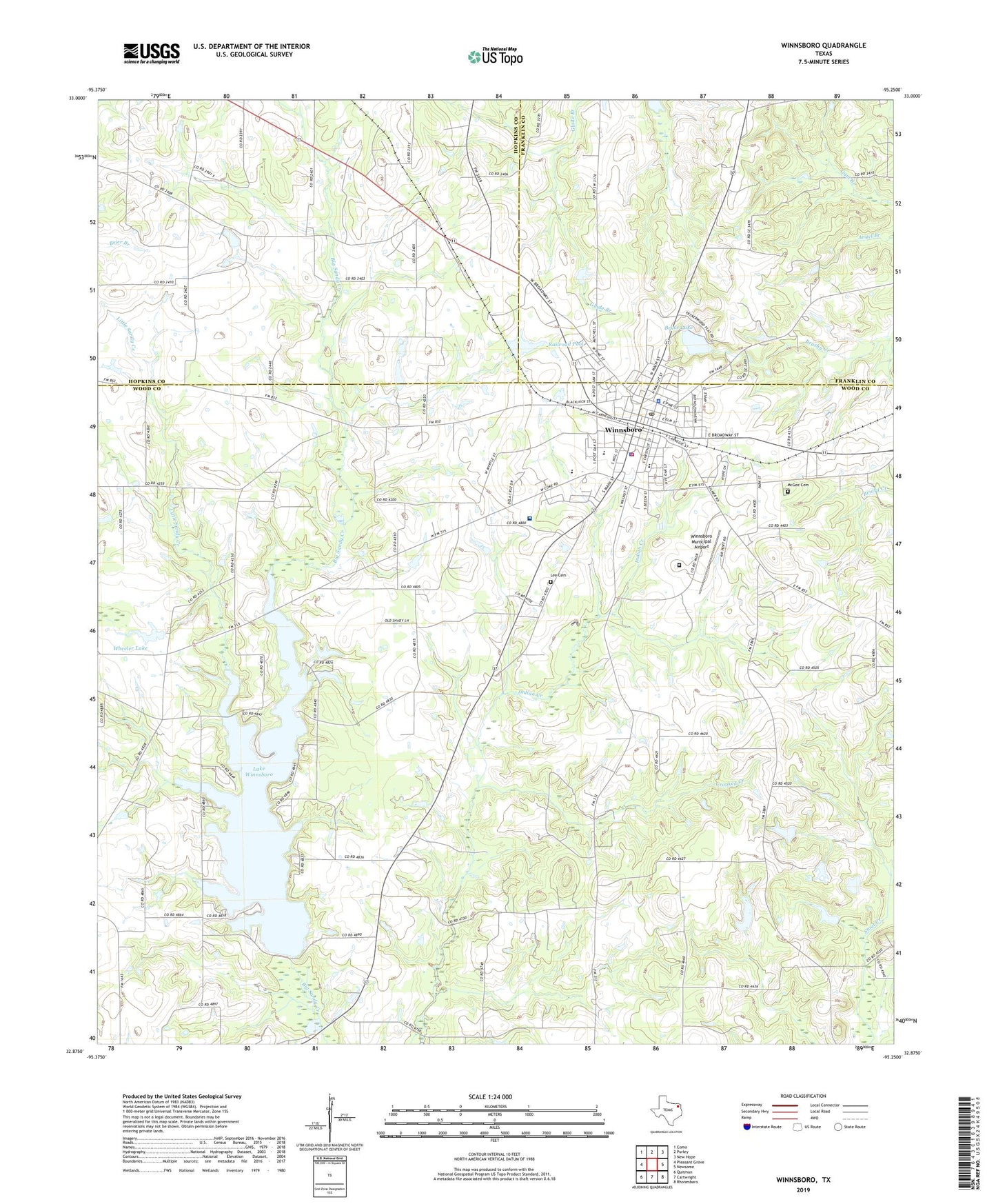
2019 topographic map quadrangle Winnsboro in the state of Texas. Scale: 1:24000. Based on the newly updated USGS 7.5' US Topo map series, this map is in the following counties: Wood, Hopkins, Franklin. The map contains contour data, water features, and other items you are used to seeing on USGS maps, but also has updated roads and other features. This is the next generation of topographic maps. Printed on high-quality waterproof paper with UV fade-resistant inks.
Quads adjacent to this one:
West: Pleasant Grove
Northwest: Como
North: Purley
Northeast: New Hope
East: Newsome
Southeast: Rhonesboro
South: Cartwright
Southwest: Quitman
Contains the following named places: Bryce Dam, Bryce Lake, Carters Lookout, Center Grove Church, CHRISTUS Mother Frances Hospital - Winnsboro, City of Winnsboro, Crooked Creek, Cross Roads Church, Forest Grove Church, Forest Grove Methodist Church, Forest Home Church, Hopewell Church, Immanuel Baptist Church, Indian Creek, KWNS-FM (Winnsboro), Lake Winnsboro, Lake Winnsboro Dam, Lee Cemetery, Little Sandy Creek, McCrary Oil Field, McGee Cemetery, Memorial Middle School, Mount Zion Church, Pickton Oil Field, Pine Street Baptist Church, Railroad Pool, Railroad Pool Dam, Red Raider Stadium, Rock Springs, Saint Francis Episcopal Church, Sharon Church, Texas Department of Criminal Justice Clyde M Johnston Unit, Tinney Chapel, Webster, Wheeler Lake, Wheeler Lake Dam, Winnsboro, Winnsboro City Hall, Winnsboro Division, Winnsboro Elementary School, Winnsboro Fire Department, Winnsboro High School, Winnsboro Independent School District Police Department, Winnsboro Municipal Airport, Winnsboro Oil Field, Winnsboro Police Department, Winnsboro Post Office, Wood County Constable's Office Precinct 4, Wylie Memorial Church, ZIP Code: 75494