MyTopo
Purley Texas US Topo Map
Couldn't load pickup availability
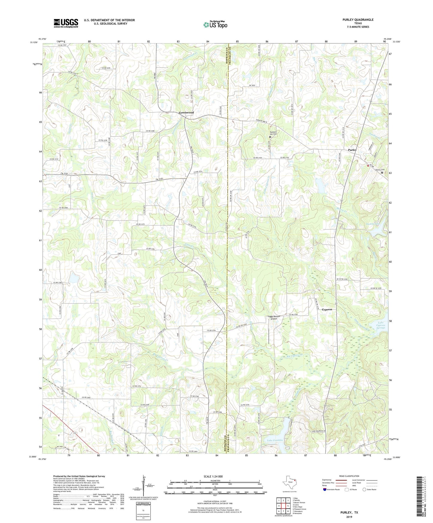
2022 topographic map quadrangle Purley in the state of Texas. Scale: 1:24000. Based on the newly updated USGS 7.5' US Topo map series, this map is in the following counties: Hopkins, Franklin. The map contains contour data, water features, and other items you are used to seeing on USGS maps, but also has updated roads and other features. This is the next generation of topographic maps. Printed on high-quality waterproof paper with UV fade-resistant inks.
Quads adjacent to this one:
West: Como
Northwest: Dike
North: Saltillo
Northeast: Mount Vernon
East: New Hope
Southeast: Newsome
South: Winnsboro
Southwest: Pleasant Grove
This map covers the same area as the classic USGS quad with code o33095a3.
Contains the following named places: Blair Creek, Coon Creek, Cypress, Cypress Church, Foggy Bottom Airport, Glade Branch, Greenwood, Harmony, Humble, Lake Franklin, Lake Franklin Dam, Liberty Cemetery, Little Cypress Creek, Morris Creek, Morris Grove, Mount Zion Church, Pine Hill, Pleasant Hill Cemetery, Purley, Purley Volunteer Fire Department, Wilcox Branch, Winterfield, Zachry Lake, Zachry Lake Dam, ZIP Code: 75471