MyTopo
Como Texas US Topo Map
Couldn't load pickup availability
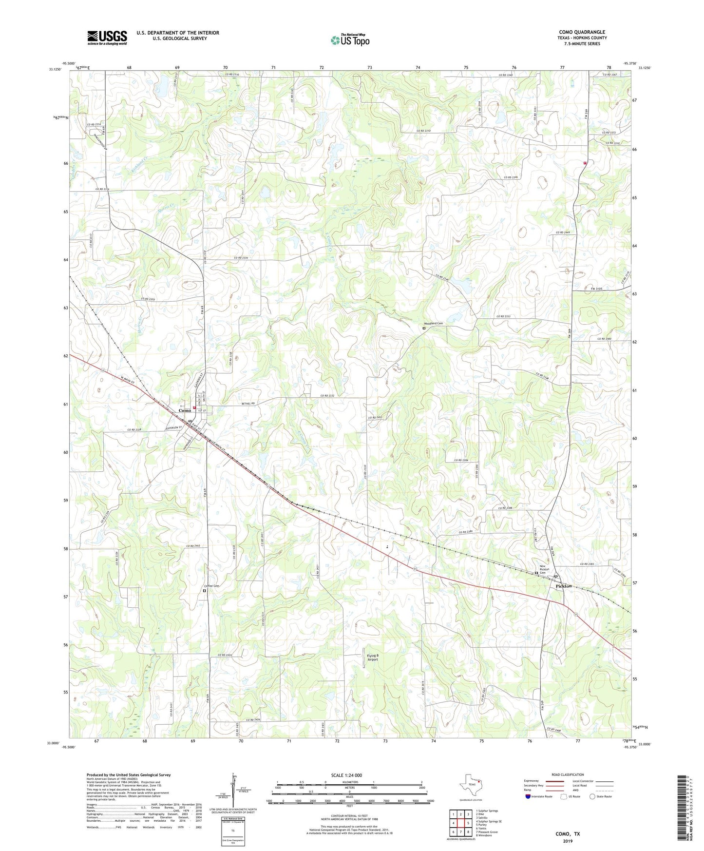
2022 topographic map quadrangle Como in the state of Texas. Scale: 1:24000. Based on the newly updated USGS 7.5' US Topo map series, this map is in the following counties: Hopkins. The map contains contour data, water features, and other items you are used to seeing on USGS maps, but also has updated roads and other features. This is the next generation of topographic maps. Printed on high-quality waterproof paper with UV fade-resistant inks.
Quads adjacent to this one:
West: Sulphur Springs SE
Northwest: Sulphur Springs
North: Dike
Northeast: Saltillo
East: Purley
Southeast: Winnsboro
South: Pleasant Grove
Southwest: Yantis
This map covers the same area as the classic USGS quad with code o33095a4.
Contains the following named places: Bethel, Coffee Cemetery, Como, Como City Hall, Como Post Office, Como Volunteer Fire Department, East Caney Church, Elm Ridge Church, Flying B Airport, Forest Academy Church, Galilee Church, Gamblin Lake, Gamblin Lake Dam, Morris Creek, New Pickton Cemetery, Pickton, Pickton - Pine Forest Volunteer Fire Department - First Responders, Pickton Post Office, Pickton-Pine Forest Division, Pine Forest, Saint Marks School, Texas No Name Number 38 Dam, Town of Como, Woodland Cemetery, ZIP Code: 75431