MyTopo
Wolf Hill Texas US Topo Map
Couldn't load pickup availability
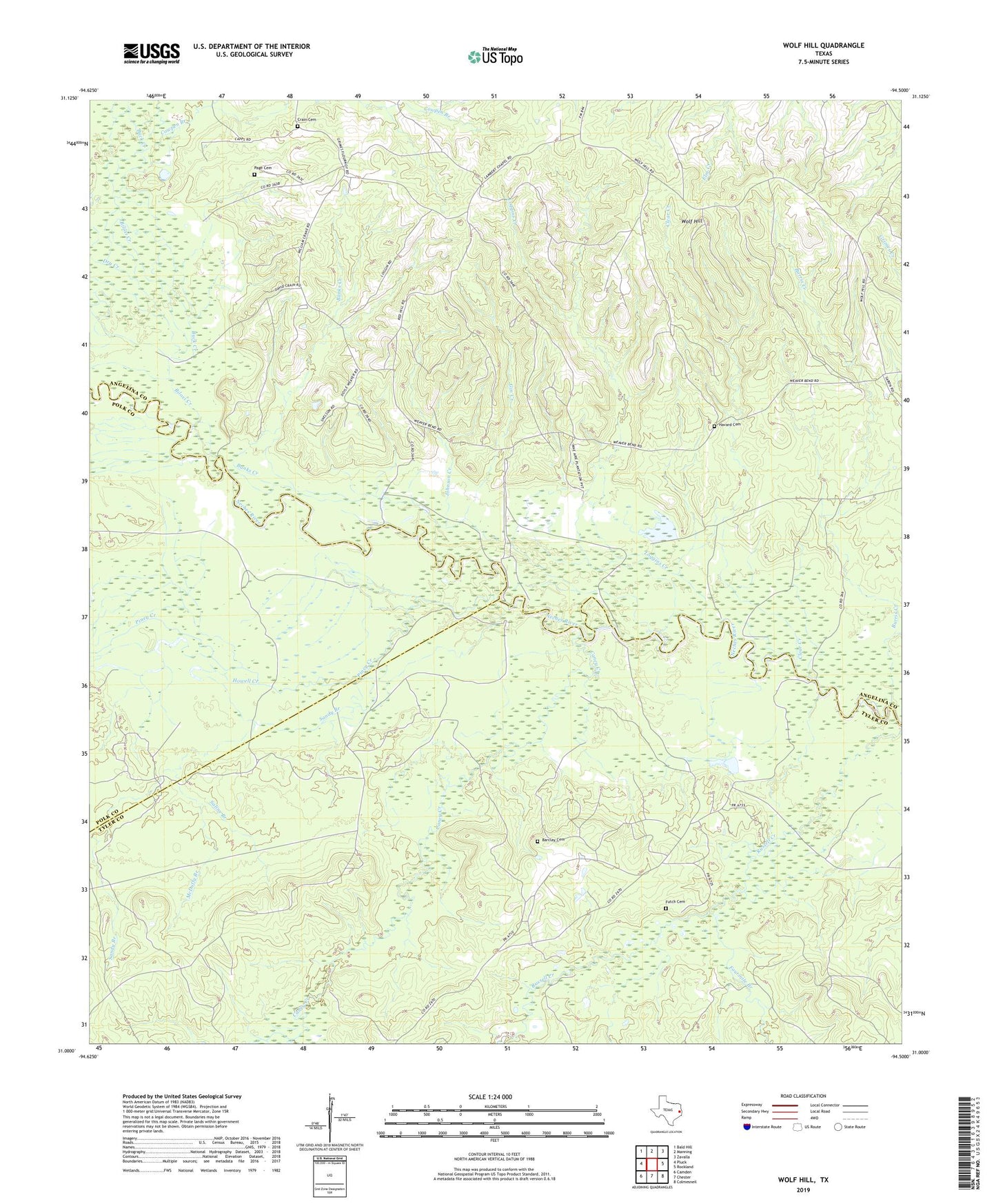
2019 topographic map quadrangle Wolf Hill in the state of Texas. Scale: 1:24000. Based on the newly updated USGS 7.5' US Topo map series, this map is in the following counties: Angelina, Tyler, Polk. The map contains contour data, water features, and other items you are used to seeing on USGS maps, but also has updated roads and other features. This is the next generation of topographic maps. Printed on high-quality waterproof paper with UV fade-resistant inks.
Quads adjacent to this one:
West: Pluck
Northwest: Bald Hill
North: Manning
Northeast: Zavalla
East: Rockland
Southeast: Colmesneil
South: Chester
Southwest: Camden
Contains the following named places: Banks Creek, Barclay Cemetery, Big Branch, Biloxi Creek, Buck Creek, Burris Creek, Caney Creek, Clear Creek, Crain Cemetery, Dry Creek, Fourmile Branch, Futch Cemetery, Gin Creek, Havard Cemetery, Howell Creek, Johnson Creek, Lambert Chapel, Loggins Creek, McDuffy Branch, Page Cemetery, Piney Creek, Powell Branch, Saline Branch, Sandy Branch, Wolf Hill, Wolf Hill Lookout Tower