MyTopo
Chester Texas US Topo Map
Couldn't load pickup availability
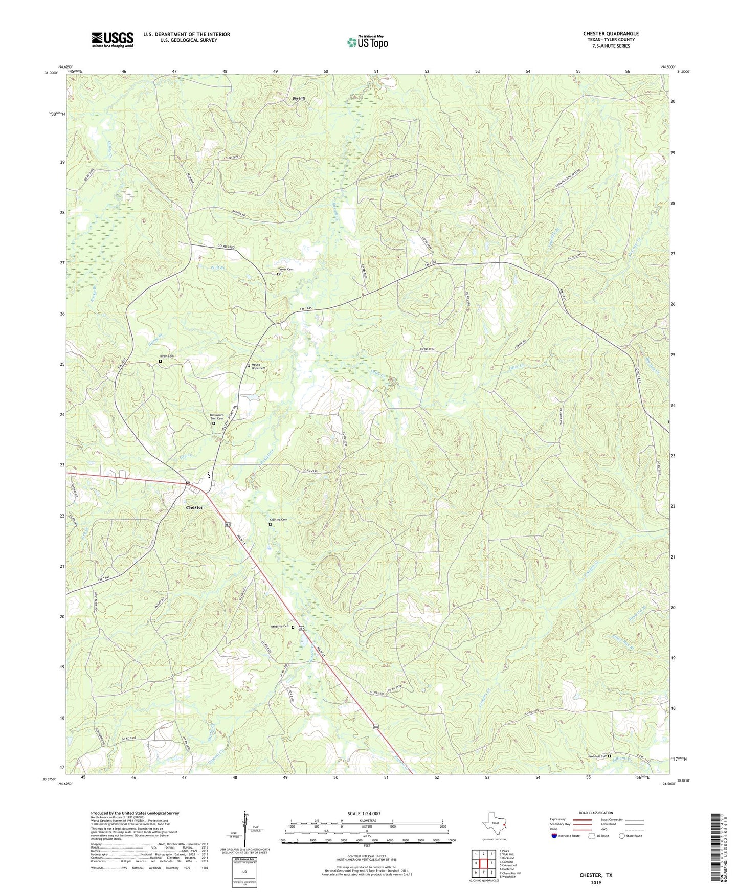
2022 topographic map quadrangle Chester in the state of Texas. Scale: 1:24000. Based on the newly updated USGS 7.5' US Topo map series, this map is in the following counties: Tyler. The map contains contour data, water features, and other items you are used to seeing on USGS maps, but also has updated roads and other features. This is the next generation of topographic maps. Printed on high-quality waterproof paper with UV fade-resistant inks.
Quads adjacent to this one:
West: Camden
Northwest: Pluck
North: Wolf Hill
Northeast: Rockland
East: Colmesneil
Southeast: Woodville
South: Chambliss Hill
Southwest: Hortense
This map covers the same area as the classic USGS quad with code o30094h5.
Contains the following named places: Big Hill, Birch Cemetery, Chester, Chester City Hall, Chester Post Office, Dry Creek, Enon Church, Hampton Church, Hardshell Cemetery, Hardy Branch, Mahaffey Cemetery, Mount Hope Cemetery, Mount Hope Church, Mount Zion Church, Myrtle Creek, Old Mount Zion Cemetery, Otter Creek, Peach Tree Village, Rocky Branch, Seamans Chapel, Sterling Cemetery, Tarver Cemetery, Town of Chester, Vincent Creek, Wolf Branch, ZIP Code: 75936