MyTopo
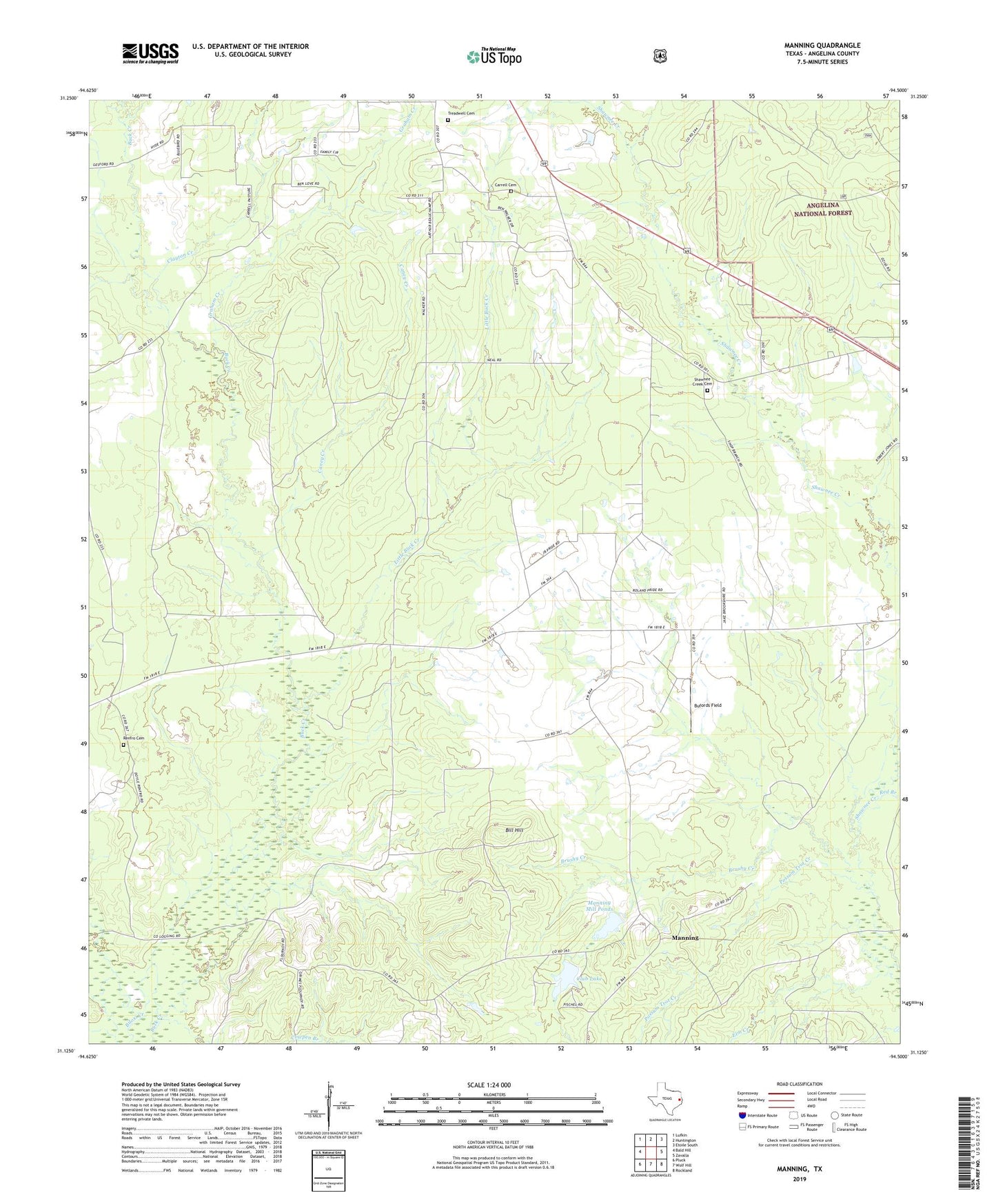
Manning Texas US Topo Map
Couldn't load pickup availability
Also explore the Manning Forest Service Topo of this same quad for updated USFS data
2022 topographic map quadrangle Manning in the state of Texas. Scale: 1:24000. Based on the newly updated USGS 7.5' US Topo map series, this map is in the following counties: Angelina. The map contains contour data, water features, and other items you are used to seeing on USGS maps, but also has updated roads and other features. This is the next generation of topographic maps. Printed on high-quality waterproof paper with UV fade-resistant inks.
Quads adjacent to this one:
West: Bald Hill
Northwest: Lufkin
North: Huntington
Northeast: Etoile South
East: Zavalla
Southeast: Rockland
South: Wolf Hill
Southwest: Pluck
This map covers the same area as the classic USGS quad with code o31094b5.
Contains the following named places: Bill Hill, Brushy Creek, Bufords Field, Caney Creek, Carrell Cemetery, Clayton Creek, Club Lake, Cowpen Branch, Elm Creek, Gibbs-Flournoy House, Graham Creek, Huntington Division, James Chapel, KDFX-AM (Huntington), Lala Hill Church, Little Buck Creek, M M Flournoy Dam, Manning, Manning Club Lake Dam, Manning Mill Ponds, Millpond, Possum Trot Creek, Red Branch, Renfro Cemetery, Salem Church, Shawnee Creek Cemetery, Shawnee Prairie, Treadwell Cemetery, ZIP Code: 75949