MyTopo
Wolfforth Texas US Topo Map
Couldn't load pickup availability
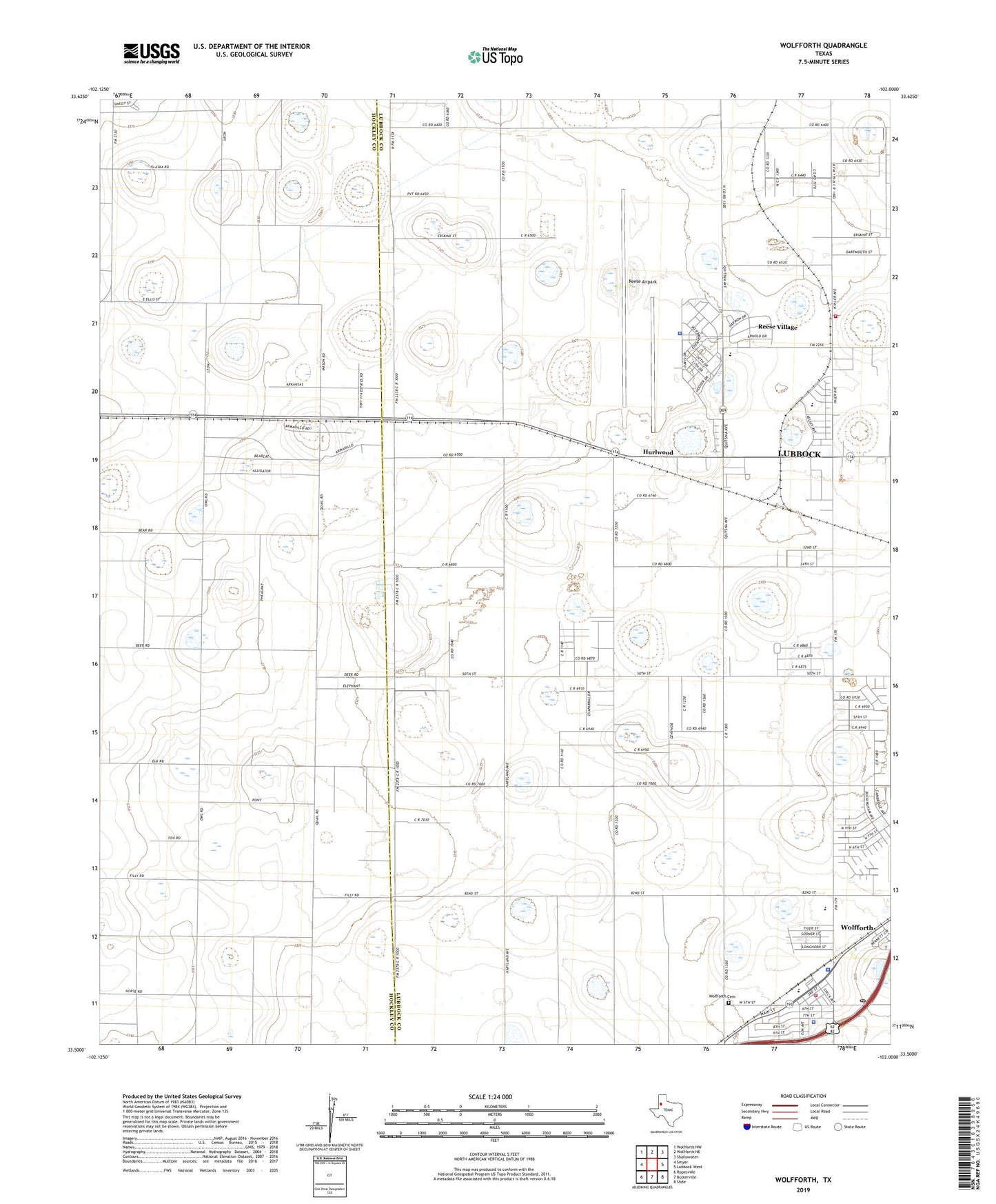
2022 topographic map quadrangle Wolfforth in the state of Texas. Scale: 1:24000. Based on the newly updated USGS 7.5' US Topo map series, this map is in the following counties: Lubbock, Hockley. The map contains contour data, water features, and other items you are used to seeing on USGS maps, but also has updated roads and other features. This is the next generation of topographic maps. Printed on high-quality waterproof paper with UV fade-resistant inks.
Quads adjacent to this one:
West: Smyer
Northwest: Wolfforth NW
North: Wolfforth NE
Northeast: Shallowater
East: Lubbock West
Southeast: Slide
South: Busterville
Southwest: Ropesville
This map covers the same area as the classic USGS quad with code o33102e1.
Contains the following named places: Bradford School, Casey Elementary School, City of Wolfforth, Frenship Independent School District Police Department, Hurlwood, Hurlwood Baptist Church, Lubbock Army Air Field, Lubbock Army Flying School, Lubbock Police Academy, Reese Air Force Base, Reese Airpark, Reese Center Census Designated Place, Reese Educational Center, Reese Village, West Carlisle Volunteer Fire Department and EMS, Wolfforth, Wolfforth Cemetery, Wolfforth City Hall, Wolfforth Fire and EMS Department, Wolfforth Police Department, Wolfforth Post Office, ZIP Code: 79407