
MyTopo
Y O Ranch Texas US Topo Map
Couldn't load pickup availability
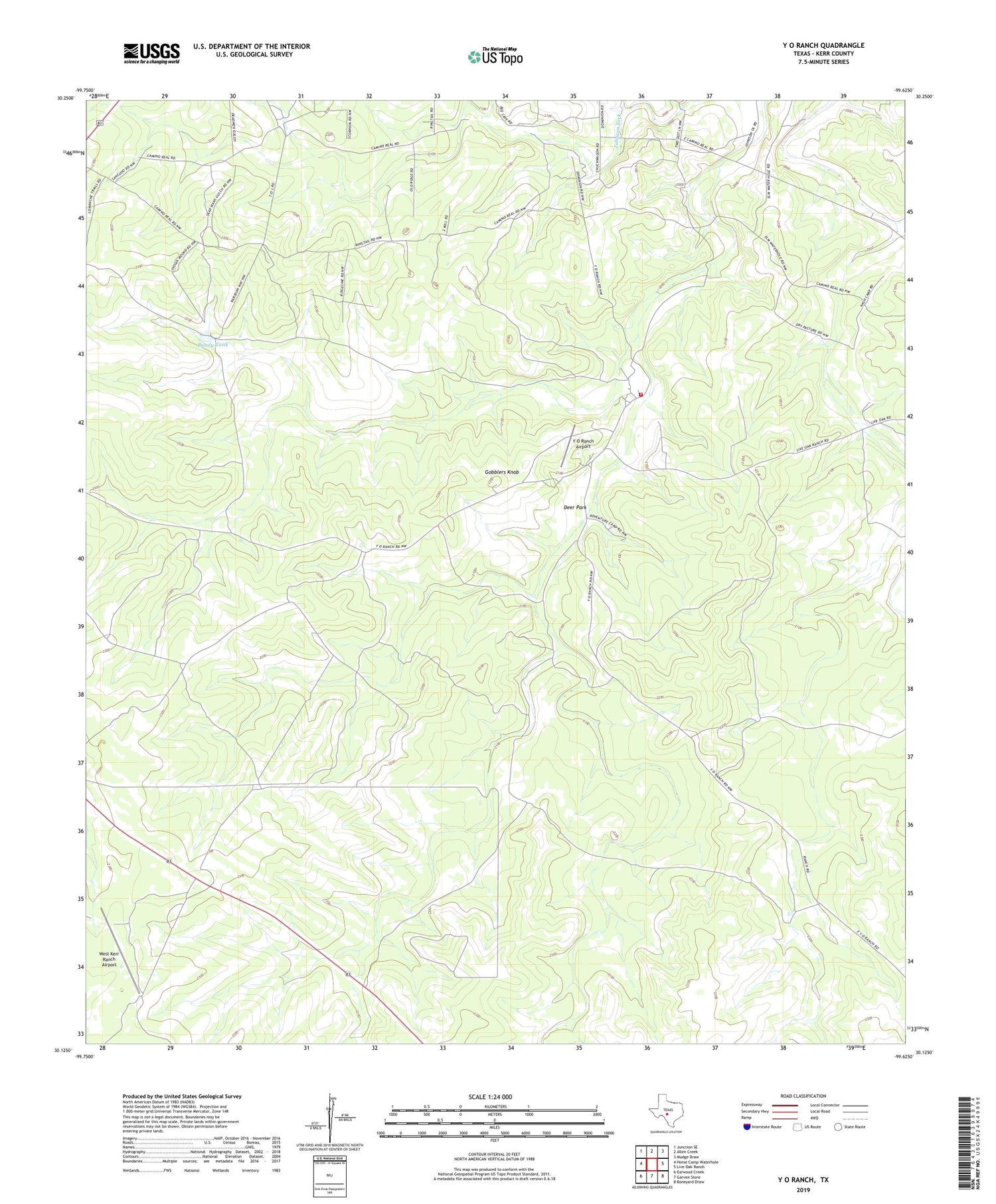
2019 topographic map quadrangle Y O Ranch in the state of Texas. Scale: 1:24000. Based on the newly updated USGS 7.5' US Topo map series, this map is in the following counties: Kerr. The map contains contour data, water features, and other items you are used to seeing on USGS maps, but also has updated roads and other features. This is the next generation of topographic maps. Printed on high-quality waterproof paper with UV fade-resistant inks.
Quads adjacent to this one:
West: Horse Camp Waterhole
Northwest: Junction SE
North: Allen Creek
Northeast: Mudge Draw
East: Live Oak Ranch
Southeast: Boneyard Draw
South: Garven Store
Southwest: Earwood Creek
Contains the following named places: Bee Cave Windmill, Bluff Windmill, Bundy Tank, Cedar Windmill, Center New Well, Deer Park, Deer Windmill, Double Gates Windmill, Gilmer Windmill, Gobblers Knob, Kerrville Windmill, Little Rincon Seco Windmill, Middle Needham Windmill, Needham House, New Well, OL Windmill, Old Feed Pen Windmill, Quatro Windmill, Rincon Seco House Windmill, Rocky Windmill, Shearing Barn Windmill, Tecolote Windmill, Trap Windmill, Walter Windmill, West Kerr Ranch Airport, Y O Ranch Airport, YO Ranch, Yo Ranch Volunteer Fire Department


