MyTopo
Live Oak Ranch Texas US Topo Map
Couldn't load pickup availability
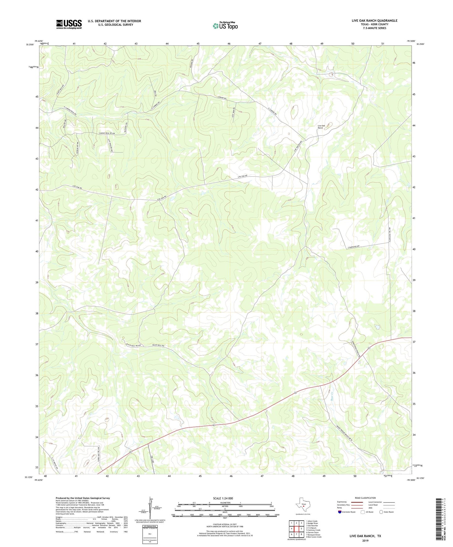
2022 topographic map quadrangle Live Oak Ranch in the state of Texas. Scale: 1:24000. Based on the newly updated USGS 7.5' US Topo map series, this map is in the following counties: Kerr. The map contains contour data, water features, and other items you are used to seeing on USGS maps, but also has updated roads and other features. This is the next generation of topographic maps. Printed on high-quality waterproof paper with UV fade-resistant inks.
Quads adjacent to this one:
West: Y O Ranch
Northwest: Allen Creek
North: Mudge Draw
Northeast: Old Noxville
East: Contrary Creek
Southeast: Bee Caves Creek
South: Boneyard Draw
Southwest: Garven Store
This map covers the same area as the classic USGS quad with code o30099b5.
Contains the following named places: Audrey Windmill, Big South Windmill, Black Bull Ranch, Charley Windmill, Four Section Windmill, Game Warden Windmill, Goat Shed Windmill, Hog Windmill, Hyatt Windmill, Little South Windmill, Live Oak Ranch, New Double Wells, New Well, New Windmill, North Windmill, Ponda Rosa Ranch, Red Windmill, Rock Springs Windmill, Steel Pens Windmill, Turkey Windmill, West Windmill, White Point Windmill, Wolf Proof Ranch