MyTopo
Boneyard Draw Texas US Topo Map
Couldn't load pickup availability
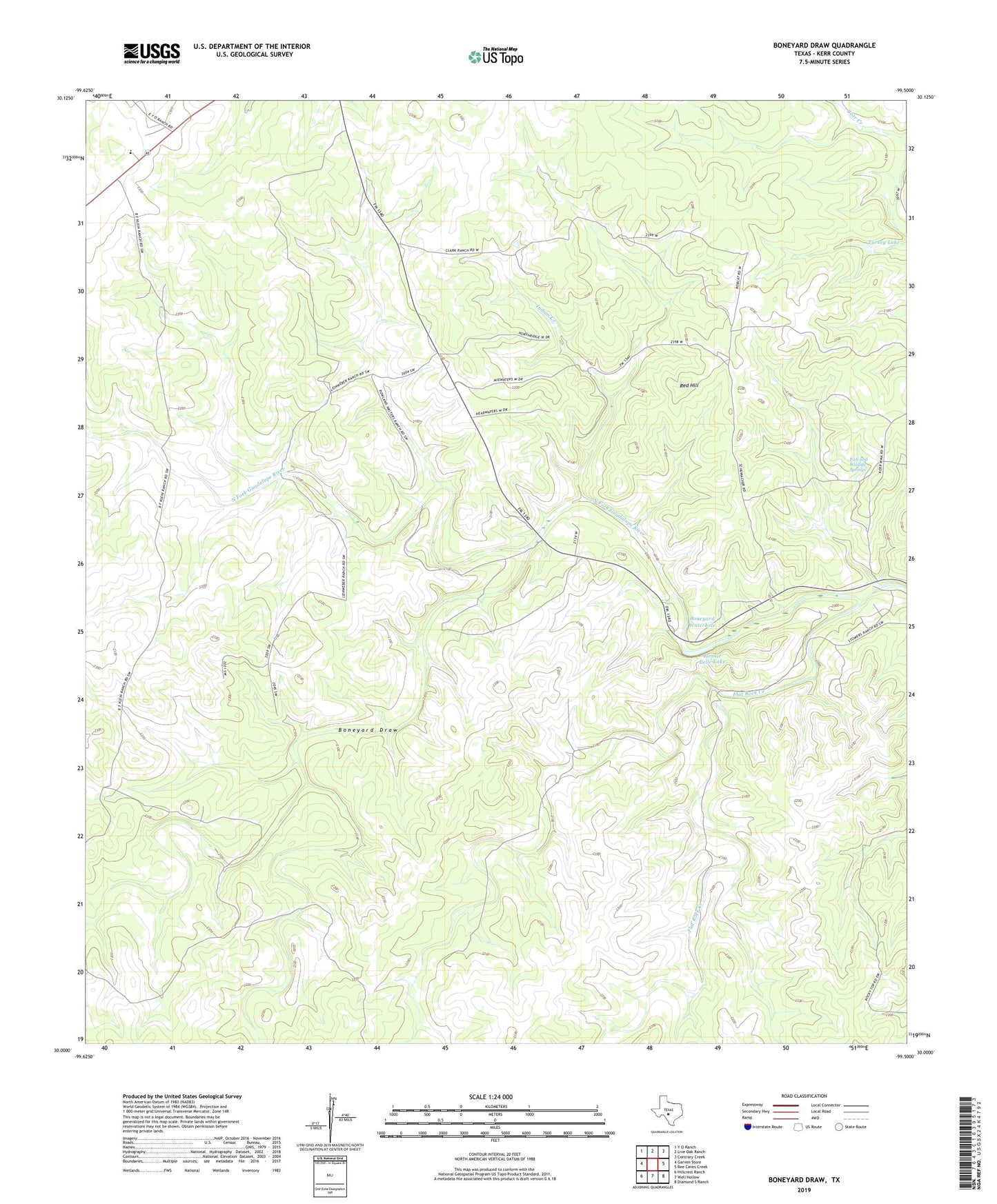
2022 topographic map quadrangle Boneyard Draw in the state of Texas. Scale: 1:24000. Based on the newly updated USGS 7.5' US Topo map series, this map is in the following counties: Kerr. The map contains contour data, water features, and other items you are used to seeing on USGS maps, but also has updated roads and other features. This is the next generation of topographic maps. Printed on high-quality waterproof paper with UV fade-resistant inks.
Quads adjacent to this one:
West: Garven Store
Northwest: Y O Ranch
North: Live Oak Ranch
Northeast: Contrary Creek
East: Bee Caves Creek
Southeast: Diamond S Ranch
South: Well Hollow
Southwest: Hillcrest Ranch
This map covers the same area as the classic USGS quad with code o30099a5.
Contains the following named places: Benson Ranch, Bobcat Windmill, Boneyard Draw, Boneyard Waterhole, Boneyard Windmill, Bonnie Belle Lake, Divide Elementary School, Divide School, Fish and Wildlife Springs, Flat Rock Creek, Flat Rock Windmill, Fox Windmill, Indian Creek, Kerr Wildlife Management Area, Love Windmill, New Windmill, Red Hill, Sampson Windmill, South Windmill, Steel Tank Windmill, Stowers Corner Windmill, Stowers Ranch Airport, Turkey Lake, ZIP Code: 78024