MyTopo
Y T Ranch Texas US Topo Map
Couldn't load pickup availability
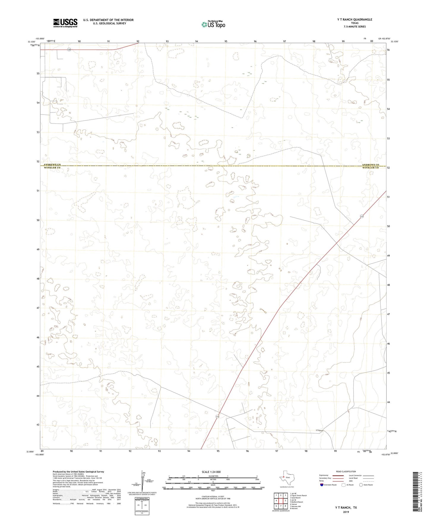
2022 topographic map quadrangle Y T Ranch in the state of Texas. Scale: 1:24000. Based on the newly updated USGS 7.5' US Topo map series, this map is in the following counties: Winkler, Andrews. The map contains contour data, water features, and other items you are used to seeing on USGS maps, but also has updated roads and other features. This is the next generation of topographic maps. Printed on high-quality waterproof paper with UV fade-resistant inks.
Quads adjacent to this one:
West: Jal SE
Northwest: Jal NE
North: Figure Seven Ranch
Northeast: Sand Ranch
East: Bedford Ranch
Southeast: Notrees
South: Notrees NW
Southwest: Vesrue
Contains the following named places: Bruce and Bar Windmill, Deep Windmill, Double Windmill, East Witcher Windmill, Flag Windmill, Humble Windmill, Kemp Windmill, Middle Windmill, North Windmill, Old Headquarters Windmill, Plum Thicket Windmill, Sand Windmill, Shell Windmill, YT Ranch