MyTopo
Yancey Texas US Topo Map
Couldn't load pickup availability
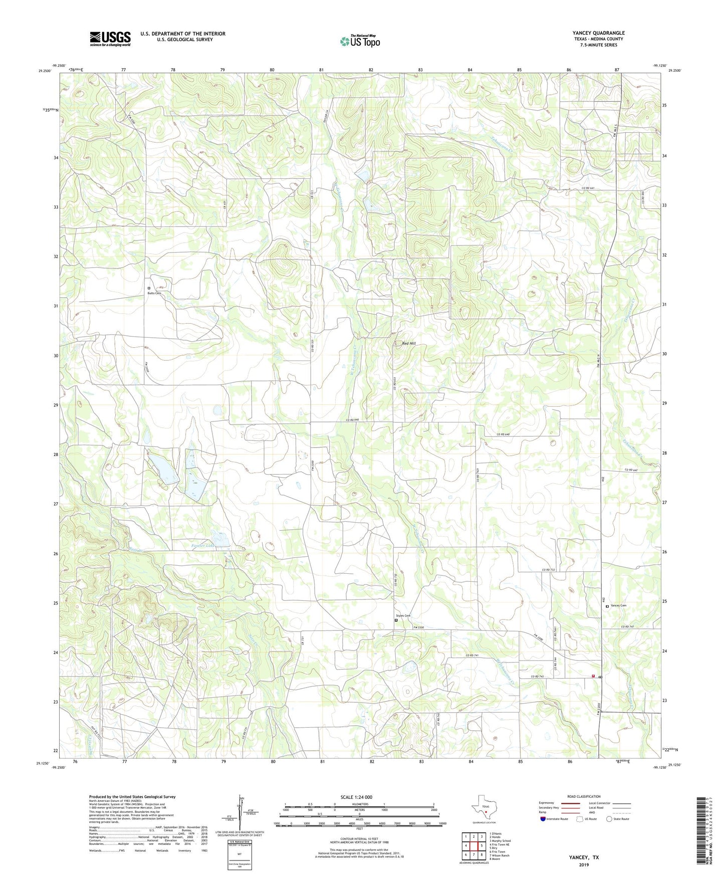
2019 topographic map quadrangle Yancey in the state of Texas. Scale: 1:24000. Based on the newly updated USGS 7.5' US Topo map series, this map is in the following counties: Medina. The map contains contour data, water features, and other items you are used to seeing on USGS maps, but also has updated roads and other features. This is the next generation of topographic maps. Printed on high-quality waterproof paper with UV fade-resistant inks.
Quads adjacent to this one:
West: Frio Town NE
North: Hondo
Northeast: Murphy School
East: Biry
Southeast: Moore
South: Wilson Ranch
Southwest: Frio Town
Contains the following named places: Butts Cemetery, Faseler Lake, Faseler Lake Dam, Hidden Valley Ranch, Hood Ranch, Red Hill, Styles Cemetery, Taylor-Ina Oil Field, Yancey, Yancey Cemetery, Yancey Census Designated Place, Yancey Post Office, Yancey Volunteer Fire Department, ZIP Code: 78886