MyTopo
Frio Town Texas US Topo Map
Couldn't load pickup availability
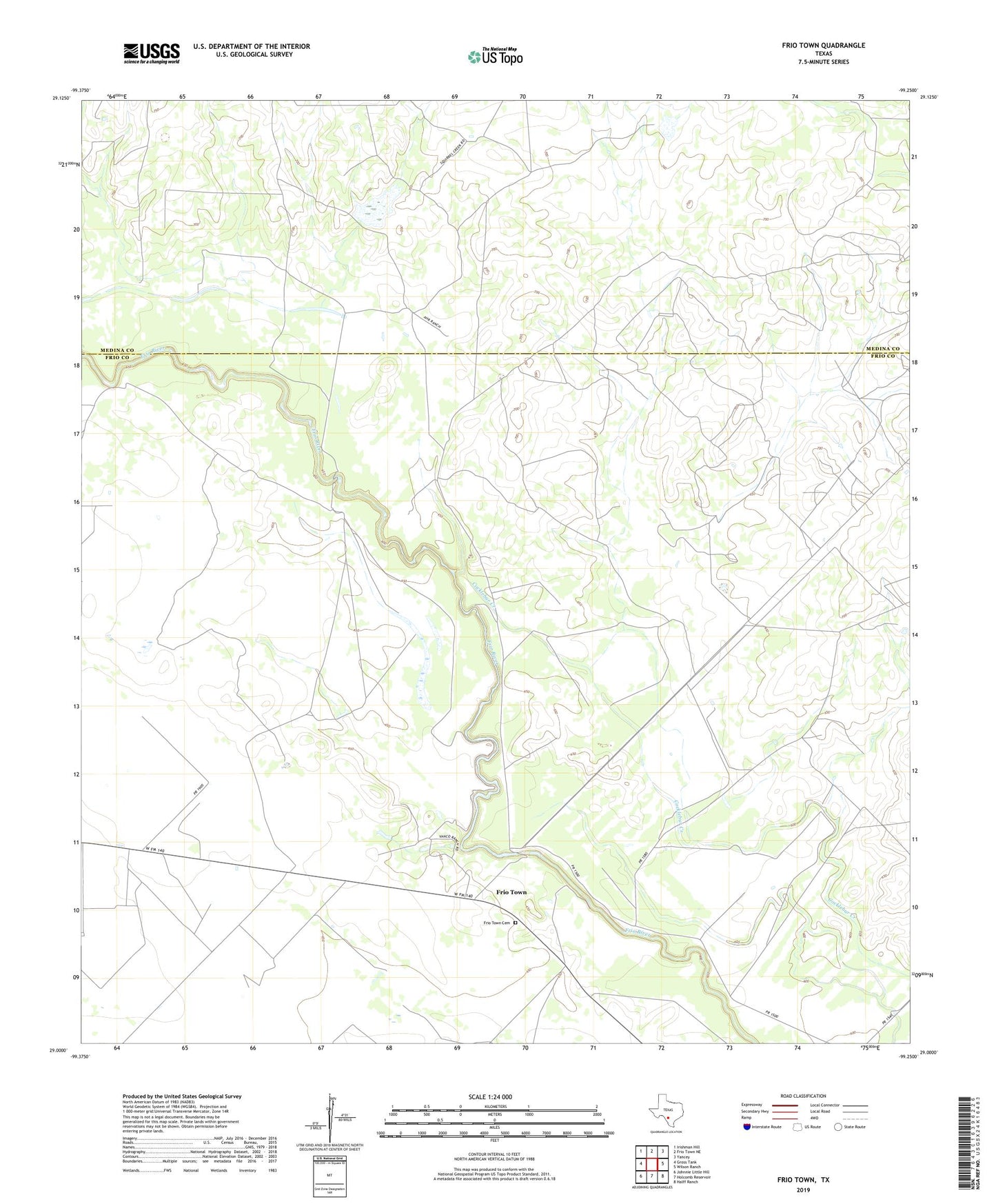
2022 topographic map quadrangle Frio Town in the state of Texas. Scale: 1:24000. Based on the newly updated USGS 7.5' US Topo map series, this map is in the following counties: Frio, Medina. The map contains contour data, water features, and other items you are used to seeing on USGS maps, but also has updated roads and other features. This is the next generation of topographic maps. Printed on high-quality waterproof paper with UV fade-resistant inks.
Quads adjacent to this one:
West: Gross Tank
Northwest: Irishman Hill
North: Frio Town NE
Northeast: Yancey
East: Wilson Ranch
Southeast: Halff Ranch
South: Holcomb Reservoir
Southwest: Johnnie Little Hill
This map covers the same area as the classic USGS quad with code o29099a3.
Contains the following named places: Beef Trap Windmill, Cow Pasture Windmill, Frio Town, Frio Town Cemetery, Frio Windmill, Headquarters Windmill, Hill Windmill, Panic Field Windmill, Rock House Ranch, Stub Windmill, T J Windmill, Texaco Number One Windmill, Texaco Number Two Windmill, Upper Brushy Windmill