MyTopo
Zephyr Texas US Topo Map
Couldn't load pickup availability
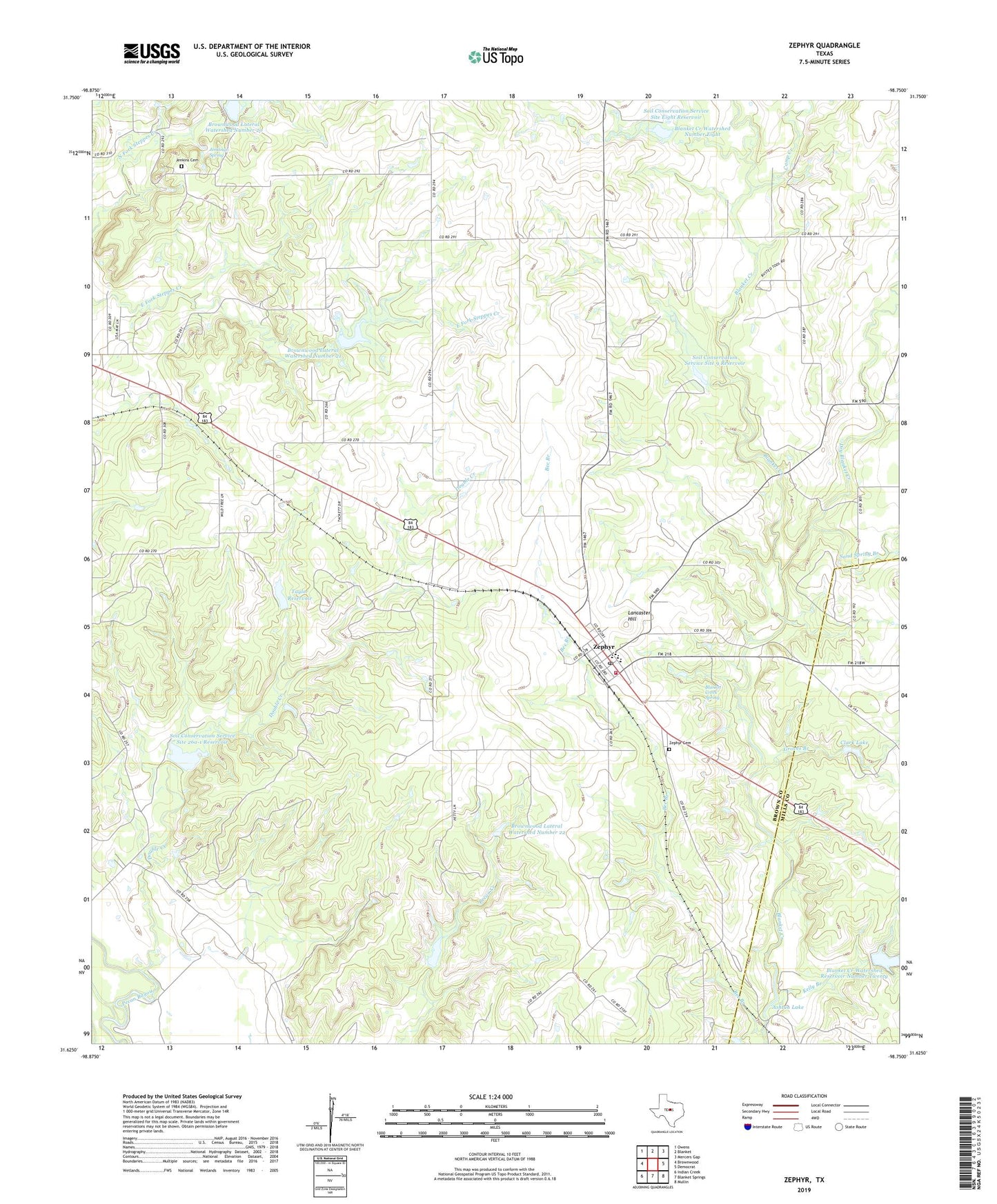
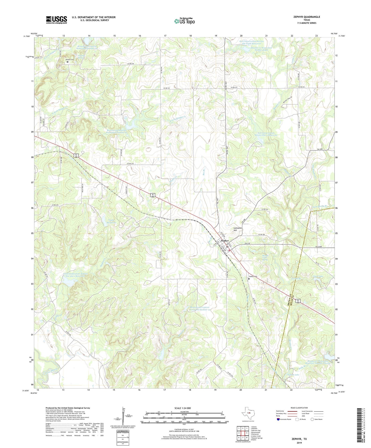
2019 topographic map quadrangle Zephyr in the state of Texas. Scale: 1:24000. Based on the newly updated USGS 7.5' US Topo map series, this map is in the following counties: Brown, Mills. The map contains contour data, water features, and other items you are used to seeing on USGS maps, but also has updated roads and other features. This is the next generation of topographic maps. Printed on high-quality waterproof paper with UV fade-resistant inks.
Quads adjacent to this one:
West: Brownwood
Northwest: Owens
North: Blanket
Northeast: Mercers Gap
East: Democrat
Southeast: Mullin
South: Blanket Springs
Southwest: Indian Creek
Contains the following named places: Ashton Lake, Ashton Lake Dam, Bee Branch, Blanket Creek Spring, Blanket Creek Watershed Number 9, Blanket Creek Watershed Number Eight, Blanket Creek Watershed Reservoir Number Twenty, Brownwood Lateral Watershed Number 20, Brownwood Lateral Watershed Number 21, Brownwood Lateral Watershed Number 22, Camp Creek, Clark Lake, Clark Lake Dam, Dirt House Branch, Double Creek, Dry Blanket Creek, Groves Branch, Jenkings Spring, Jenkins Cemetery, Kelly Branch, Lancaster Hill, Sand Spring Branch, Soil Conservation Service Site 20 Dam, Soil Conservation Service Site 20 Reservoir, Soil Conservation Service Site 21 Dam, Soil Conservation Service Site 22 Dam, Soil Conservation Service Site 22 Reservoir, Soil Conservation Service Site 26a-1 Dam, Soil Conservation Service Site 26a-1 Reservoir, Soil Conservation Service Site 8 Dam, Soil Conservation Service Site 9 Dam, Soil Conservation Service Site 9 Reservoir, Soil Conservation Service Site Eight Reservoir, Taylor Dam, Taylor Reservoir, Zephyr, Zephyr Cemetery, Zephyr Census Designated Place, Zephyr Elementary School, Zephyr High School, Zephyr Post Office, Zephyr Volunteer Fire Department, ZIP Code: 76890