MyTopo
Mullin Texas US Topo Map
Couldn't load pickup availability
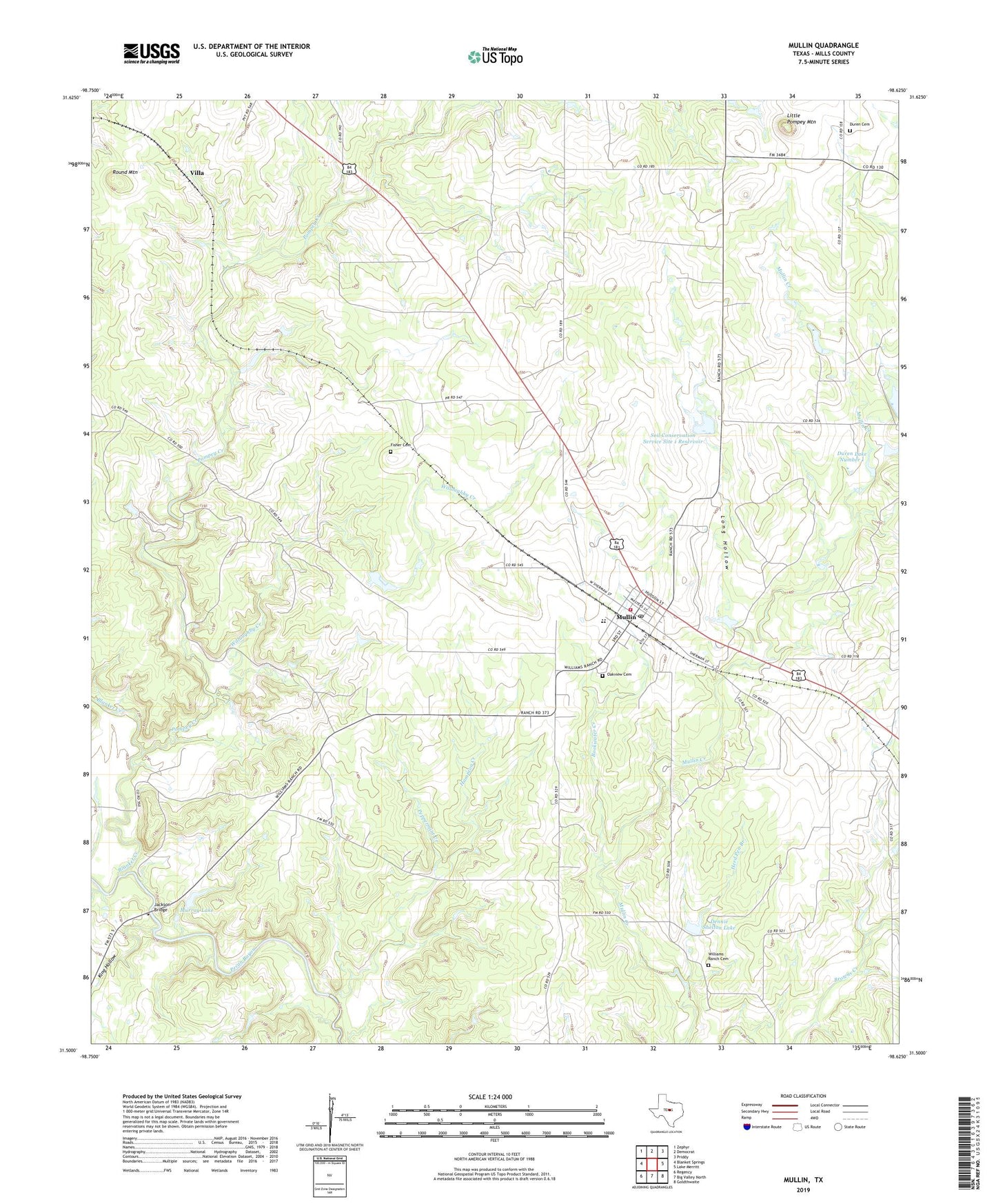
2022 topographic map quadrangle Mullin in the state of Texas. Scale: 1:24000. Based on the newly updated USGS 7.5' US Topo map series, this map is in the following counties: Mills. The map contains contour data, water features, and other items you are used to seeing on USGS maps, but also has updated roads and other features. This is the next generation of topographic maps. Printed on high-quality waterproof paper with UV fade-resistant inks.
Quads adjacent to this one:
West: Blanket Springs
Northwest: Zephyr
North: Democrat
Northeast: Priddy
East: Lake Merritt
Southeast: Goldthwaite
South: Big Valley North
Southwest: Regency
This map covers the same area as the classic USGS quad with code o31098e6.
Contains the following named places: Blanket Creek, Bookwater Creek, Dennie Shelton Lake, Dennie Shelton Lake Dam, Duren Cemetery, Duren Lake Number 1, Duren Lake Number 1 Dam, Fisher Cemetery, Hampton Creek, Herd Pen Branch, Jackson Bridge, King Hollow, Little Pompey Mountain, Long Hollow, Mullin, Mullin City Hall, Mullin Post Office, Mullin School, Mullin Volunteer Fire Department, Murray Lake, Murray Lake Dam, Oakview Cemetery, Peppermint Creek, Pompey Creek, Pompey Mountain Church, Round Mountain, Soil Conservation Service Site 1 Dam, Soil Conservation Service Site 1 Reservoir, Soil Conservation Service Site 2 Dam, Town of Mullin, Villa, Williams Ranch Cemetery, Willoughby Creek, ZIP Code: 76864