MyTopo
Blanket Springs Texas US Topo Map
Couldn't load pickup availability
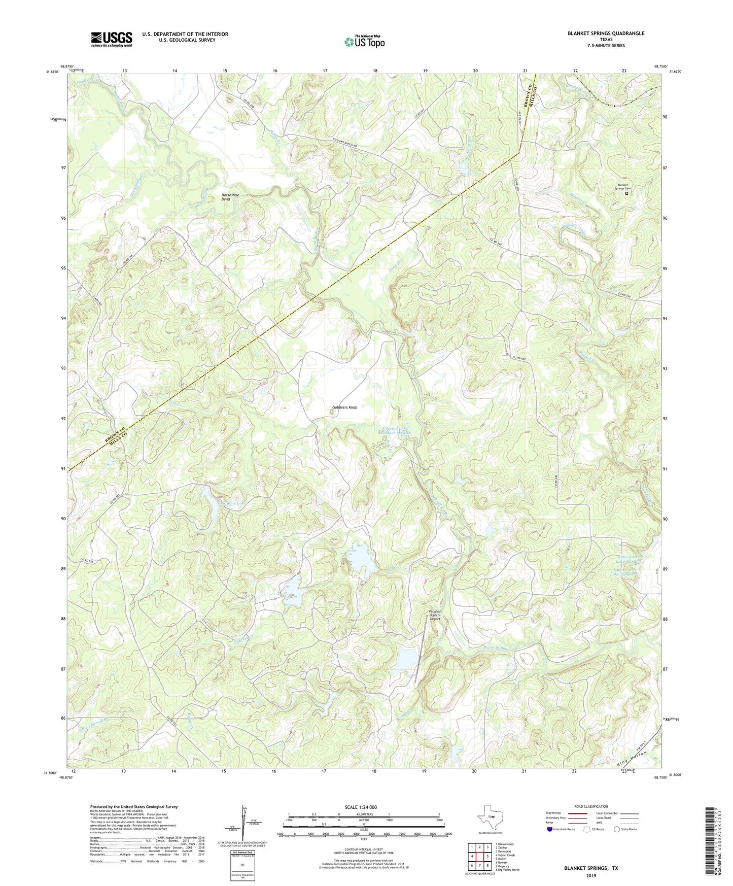
2022 topographic map quadrangle Blanket Springs in the state of Texas. Scale: 1:24000. Based on the newly updated USGS 7.5' US Topo map series, this map is in the following counties: Mills, Brown. The map contains contour data, water features, and other items you are used to seeing on USGS maps, but also has updated roads and other features. This is the next generation of topographic maps. Printed on high-quality waterproof paper with UV fade-resistant inks.
Quads adjacent to this one:
West: Indian Creek
Northwest: Brownwood
North: Zephyr
Northeast: Democrat
East: Mullin
Southeast: Big Valley North
South: Regency
Southwest: Bowser
This map covers the same area as the classic USGS quad with code o31098e7.
Contains the following named places: Blanket Springs, Blanket Springs Cemetery, Childress Lake, Childress Lake Dam, Clayton Lake Number 1 South, Clayton Lake Number 1 South Dam, Clayton Lake Number 2 North, Clayton Lake Number 2 North Dam, Devils River, Duke Crossing, Fisk Creek, Fisk Crossing, Gobblers Knob, Horseshoe Bend, John Graves Dam Number 2, John Graves Dam Number 3, John Graves Dam Number 4, John Graves Dam Number 5, John Graves Lake Number 2, John Graves Lake Number 3, John Graves Lake Number 4, John Graves Lake Number 5, Long Branch, Mackinally Creek, Mars Branch, Panther Creek, Pecan Creek, Rough Creek, Soil Conservation Service Site 23 Dam, Soil Conservation Service Site 23 Reservoir, Vaughan Ranch Airport, Williams Lake, Williams Lake Dam