MyTopo
Antelope Island Utah US Topo Map
Couldn't load pickup availability
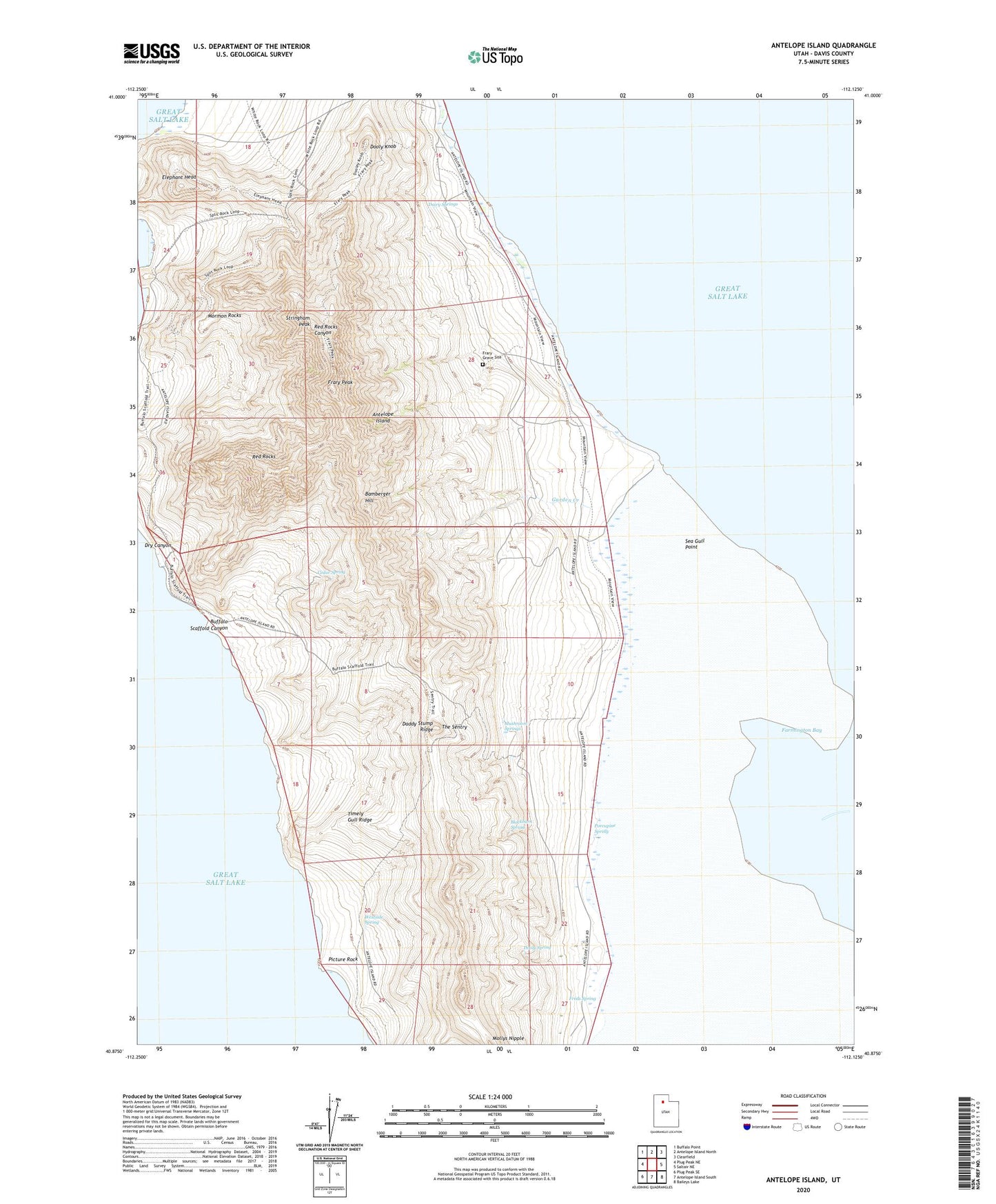
2023 topographic map quadrangle Antelope Island in the state of Utah. Scale: 1:24000. Based on the newly updated USGS 7.5' US Topo map series, this map is in the following counties: Davis. The map contains contour data, water features, and other items you are used to seeing on USGS maps, but also has updated roads and other features. This is the next generation of topographic maps. Printed on high-quality waterproof paper with UV fade-resistant inks.
Quads adjacent to this one:
West: Plug Peak NE
Northwest: Buffalo Point
North: Antelope Island North
Northeast: Clearfield
East: Saltair NE
Southeast: Baileys Lake
South: Antelope Island South
Southwest: Plug Peak SE
This map covers the same area as the classic USGS quad with code o40112h2.
Contains the following named places: Antelope Island, Bamberger Hill, Blackburn Spring, Buffalo Scaffold Canyon, Cedar Spring, Daddy Stump Ridge, Dairy Springs, Dooly Knob, Dooly Spring, Dry Canyon, Elephant Head, Frary Grave Site, Frary Peak, Freds Spring, Garden Creek, Mormon Rocks, Mushroom Springs, Picture Rock, Porcupine Spring, Red Rocks, Sea Gull Point, Split Rock Bay, Stringham Peak, The Sentry, Timely Gull Ridge, Westside Spring