
MyTopo
Anthro Mountain Utah US Topo Map
Couldn't load pickup availability
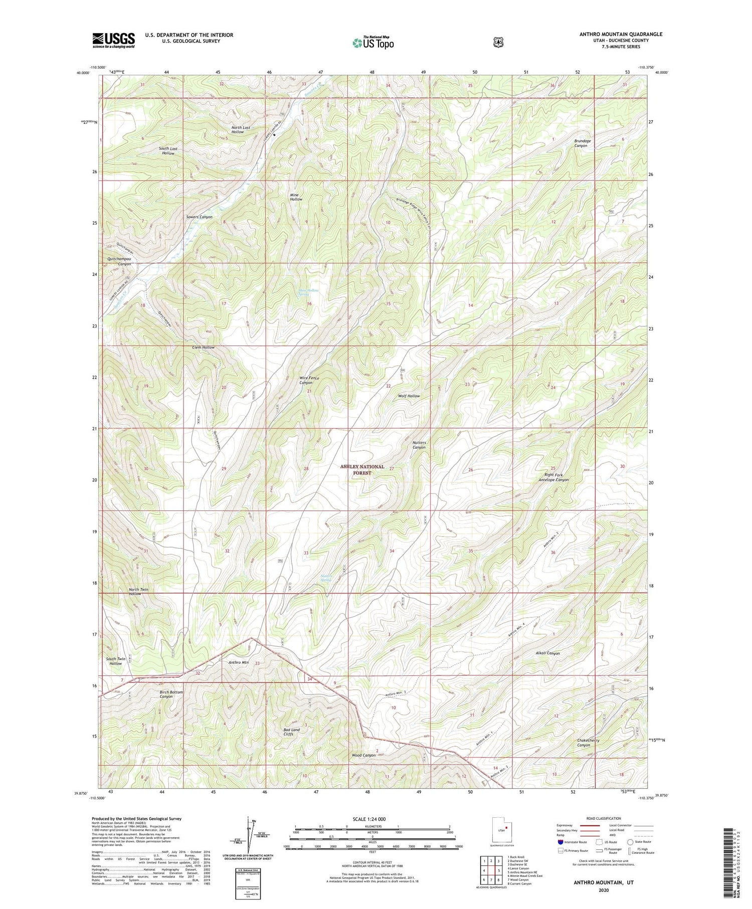
2020 topographic map quadrangle Anthro Mountain in the state of Utah. Scale: 1:24000. Based on the newly updated USGS 7.5' US Topo map series, this map is in the following counties: Duchesne. The map contains contour data, water features, and other items you are used to seeing on USGS maps, but also has updated roads and other features. This is the next generation of topographic maps. Printed on high-quality waterproof paper with UV fade-resistant inks.
Quads adjacent to this one:
West: Lance Canyon
Northwest: Buck Knoll
North: Duchesne SW
Northeast: Duchesne SE
East: Anthro Mountain NE
Southeast: Currant Canyon
South: Wood Canyon
Southwest: Minnie Maud Creek East
Contains the following named places: Anthro Mountain, Clem Hollow, Cracker Grove, Mine Hollow, Mine Hollow Spring, North Lost Hollow, Nutters Spring, Quitchampau Canyon, South Lost Hollow, Wolf Hollow


