MyTopo
Minnie Maud Creek East Utah US Topo Map
Couldn't load pickup availability
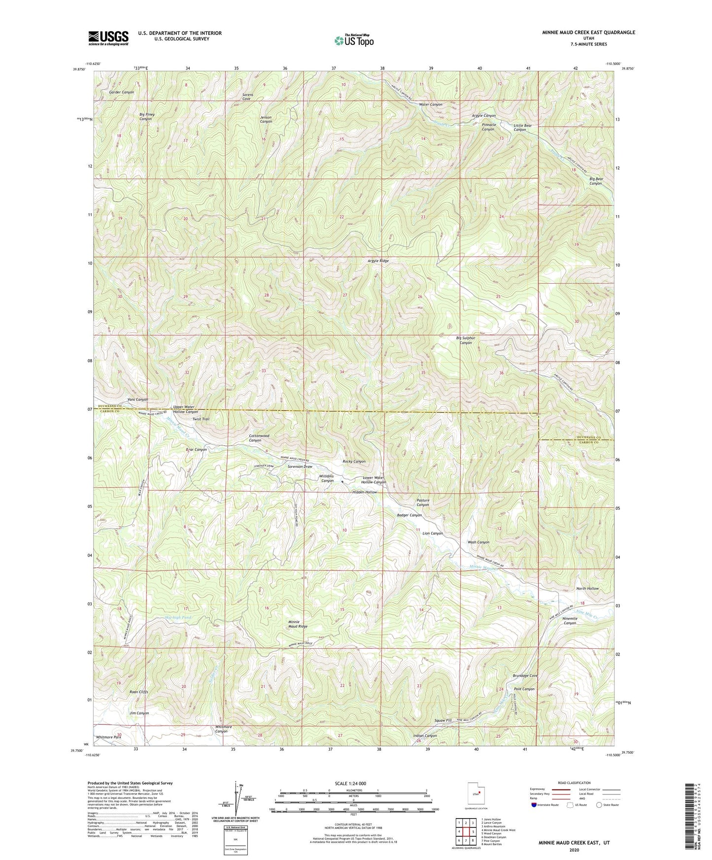
2023 topographic map quadrangle Minnie Maud Creek East in the state of Utah. Scale: 1:24000. Based on the newly updated USGS 7.5' US Topo map series, this map is in the following counties: Duchesne, Carbon. The map contains contour data, water features, and other items you are used to seeing on USGS maps, but also has updated roads and other features. This is the next generation of topographic maps. Printed on high-quality waterproof paper with UV fade-resistant inks.
Quads adjacent to this one:
West: Minnie Maud Creek West
Northwest: Jones Hollow
North: Lance Canyon
Northeast: Anthro Mountain
East: Wood Canyon
Southeast: Mount Bartles
South: Pine Canyon
Southwest: Deadman Canyon
This map covers the same area as the classic USGS quad with code o39110g5.
Contains the following named places: Badger Canyon, Bear Canyon, Big Bear Canyon, Brundage Cove, Cottonwood Canyon, Hidden Hollow, Indian Canyon, Jim Canyon, Lion Canyon, Little Bear Canyon, Lower Water Hollow Canyon, Minnie Maud Creek, North Hollow, Pasture Canyon, Pinnacle Canyon, Pole Canyon, Rocky Canyon, Sky-high Pond, Sorenson Draw, Squaw Fill, Twist Trail, Upper Water Hollow Canyon, Vans Canyon, Wash Canyon, Water Canyon, Whitmore Canyon, Whitmore Park, Williams Canyon