MyTopo
Archy Bench SE Utah US Topo Map
Couldn't load pickup availability
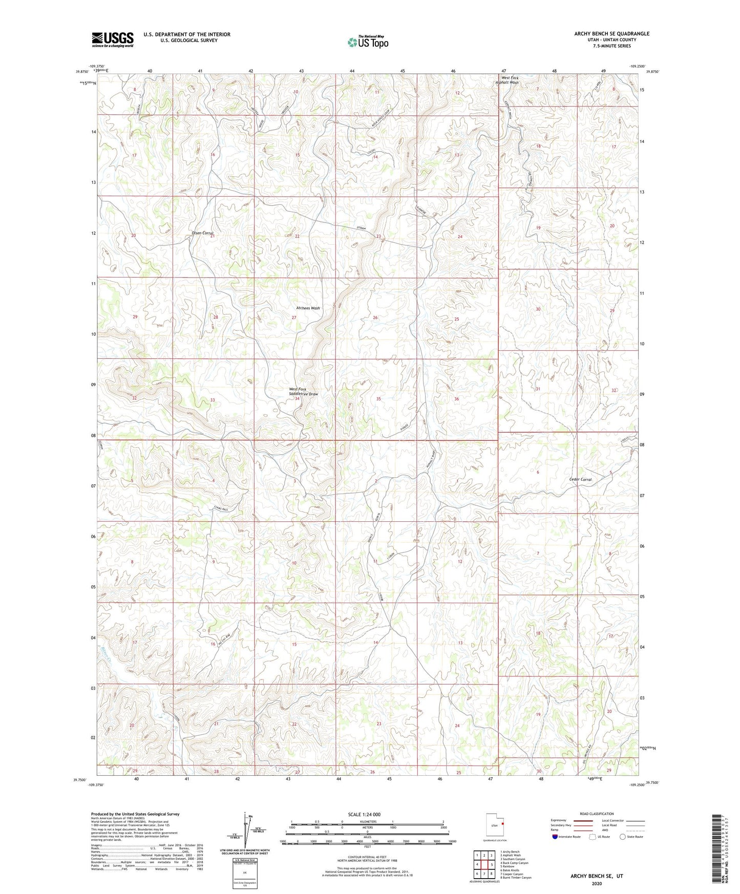
2023 topographic map quadrangle Archy Bench SE in the state of Utah. Scale: 1:24000. Based on the newly updated USGS 7.5' US Topo map series, this map is in the following counties: Uintah. The map contains contour data, water features, and other items you are used to seeing on USGS maps, but also has updated roads and other features. This is the next generation of topographic maps. Printed on high-quality waterproof paper with UV fade-resistant inks.
Quads adjacent to this one:
West: Buck Camp Canyon
Northwest: Archy Bench
North: Asphalt Wash
Northeast: Southam Canyon
East: Rainbow
Southeast: Burnt Timber Canyon
South: Cooper Canyon
Southwest: Bates Knolls
This map covers the same area as the classic USGS quad with code o39109g3.
Contains the following named places: Cedar Corral, Olsen Corral, Rock House Gas Field, Seely Cabin