MyTopo
Bar X Wash Utah US Topo Map
Couldn't load pickup availability
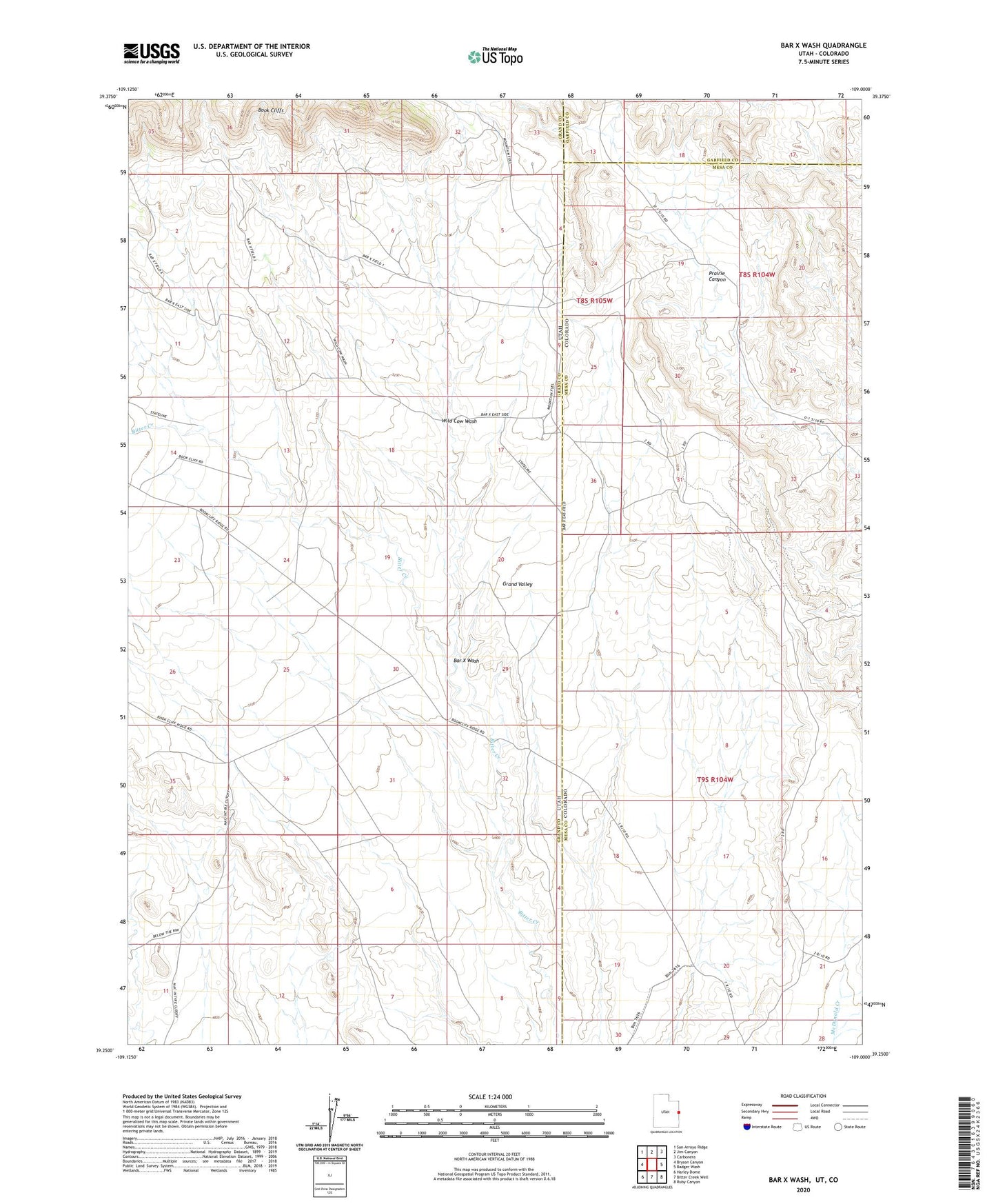
2023 topographic map quadrangle Bar X Wash in the state of Utah. Scale: 1:24000. Based on the newly updated USGS 7.5' US Topo map series, this map is in the following counties: Grand, Mesa, Garfield. The map contains contour data, water features, and other items you are used to seeing on USGS maps, but also has updated roads and other features. This is the next generation of topographic maps. Printed on high-quality waterproof paper with UV fade-resistant inks.
Quads adjacent to this one:
West: Bryson Canyon
Northwest: San Arroyo Ridge
North: Jim Canyon
Northeast: Carbonera
East: Badger Wash
Southeast: Ruby Canyon
South: Bitter Creek Well
Southwest: Harley Dome
This map covers the same area as the classic USGS quad with code o39109c1.
Contains the following named places: Bar X Gas Field, Bar X Wash, Stateline Gas Field, Wild Cow Wash