
MyTopo
Beehive Peak Utah US Topo Map
Couldn't load pickup availability
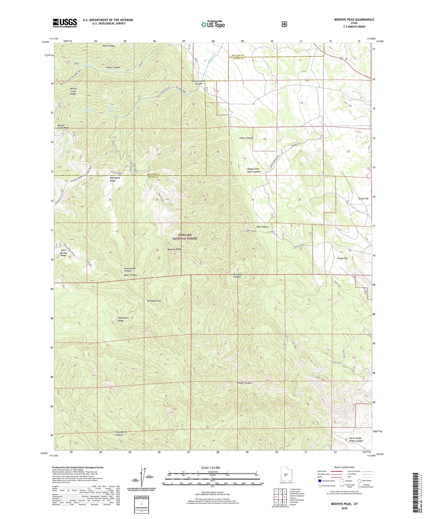
2020 topographic map quadrangle Beehive Peak in the state of Utah. Scale: 1:24000. Based on the newly updated USGS 7.5' US Topo map series, this map is in the following counties: Sevier, Millard. The map contains contour data, water features, and other items you are used to seeing on USGS maps, but also has updated roads and other features. This is the next generation of topographic maps. Printed on high-quality waterproof paper with UV fade-resistant inks.
Quads adjacent to this one:
West: Mount Catherine
Northwest: Coffee Peak
North: Scipio Lake
Northeast: Redmond Canyon
East: Aurora
Southeast: Sigurd
South: Richfield
Southwest: White Pine Peak
Contains the following named places: Amos Canyon, Bean Canyon, Beehive Peak, Ezras Flat, Frogs Flat, Herbert Ranch, Kennedy Fork, Mahogany Ridge, Middle Fork Amos Canyon, North Cedar Ridge Canyon, Pharo Canyon, Red Canyon, Rock Springs Ridge, Sweetwater Canyon, Trough Canyon, Willow Creek Canyon, Willow Creek Ridge, Willow Creek Spring


