MyTopo
Redmond Canyon Utah US Topo Map
Couldn't load pickup availability
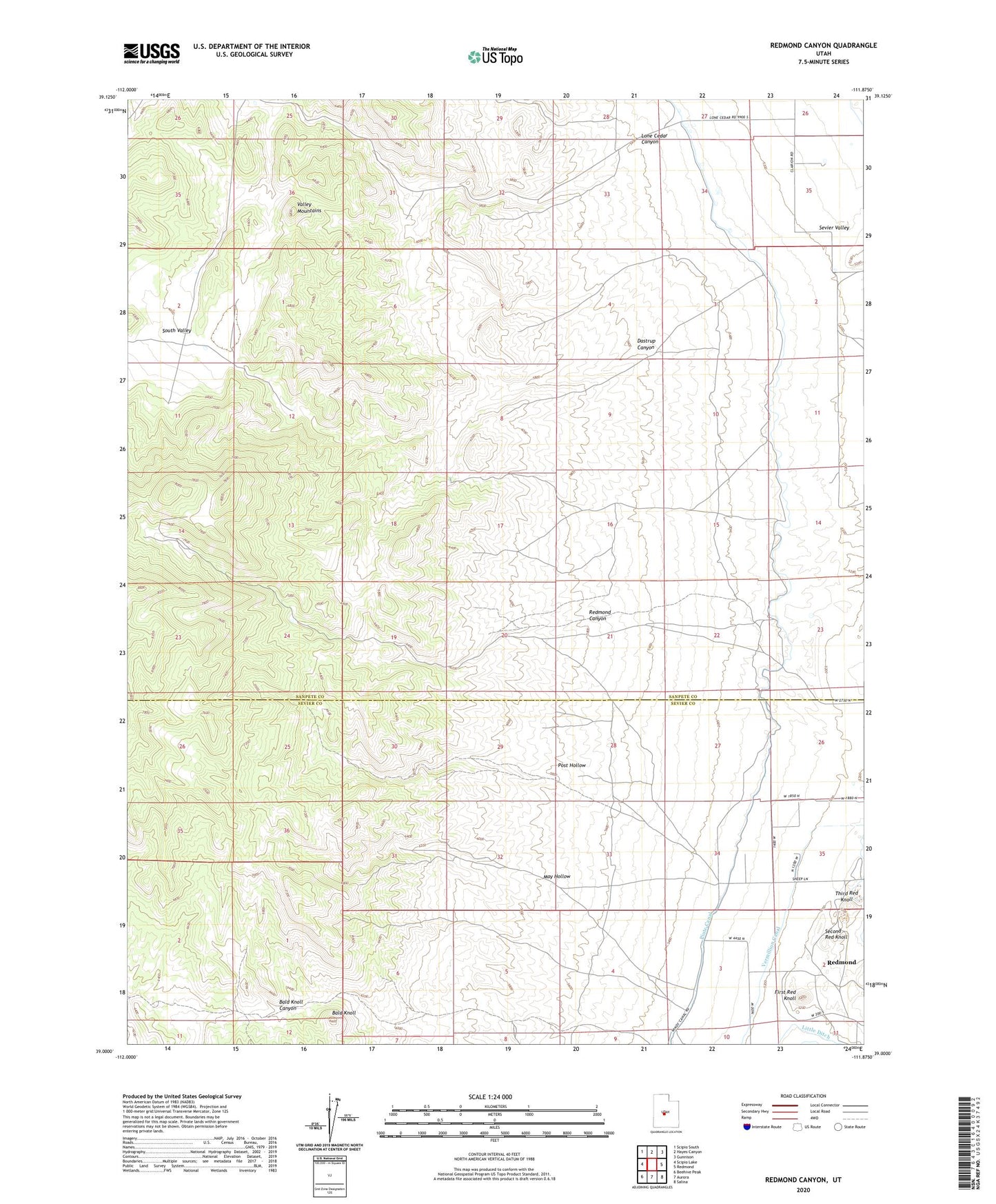
2023 topographic map quadrangle Redmond Canyon in the state of Utah. Scale: 1:24000. Based on the newly updated USGS 7.5' US Topo map series, this map is in the following counties: Sanpete, Sevier. The map contains contour data, water features, and other items you are used to seeing on USGS maps, but also has updated roads and other features. This is the next generation of topographic maps. Printed on high-quality waterproof paper with UV fade-resistant inks.
Quads adjacent to this one:
West: Scipio Lake
Northwest: Scipio South
North: Hayes Canyon
Northeast: Gunnison
East: Redmond
Southeast: Salina
South: Aurora
Southwest: Beehive Peak
This map covers the same area as the classic USGS quad with code o39111a8.
Contains the following named places: Bald Knoll, Dastrup Canyon, First Red Knoll, Lone Cedar Canyon, May Hollow, Piute Canal, Post Hollow, Redmond Canyon, Second Red Knoll, Sevier Valley, South Valley, Third Red Knoll