MyTopo
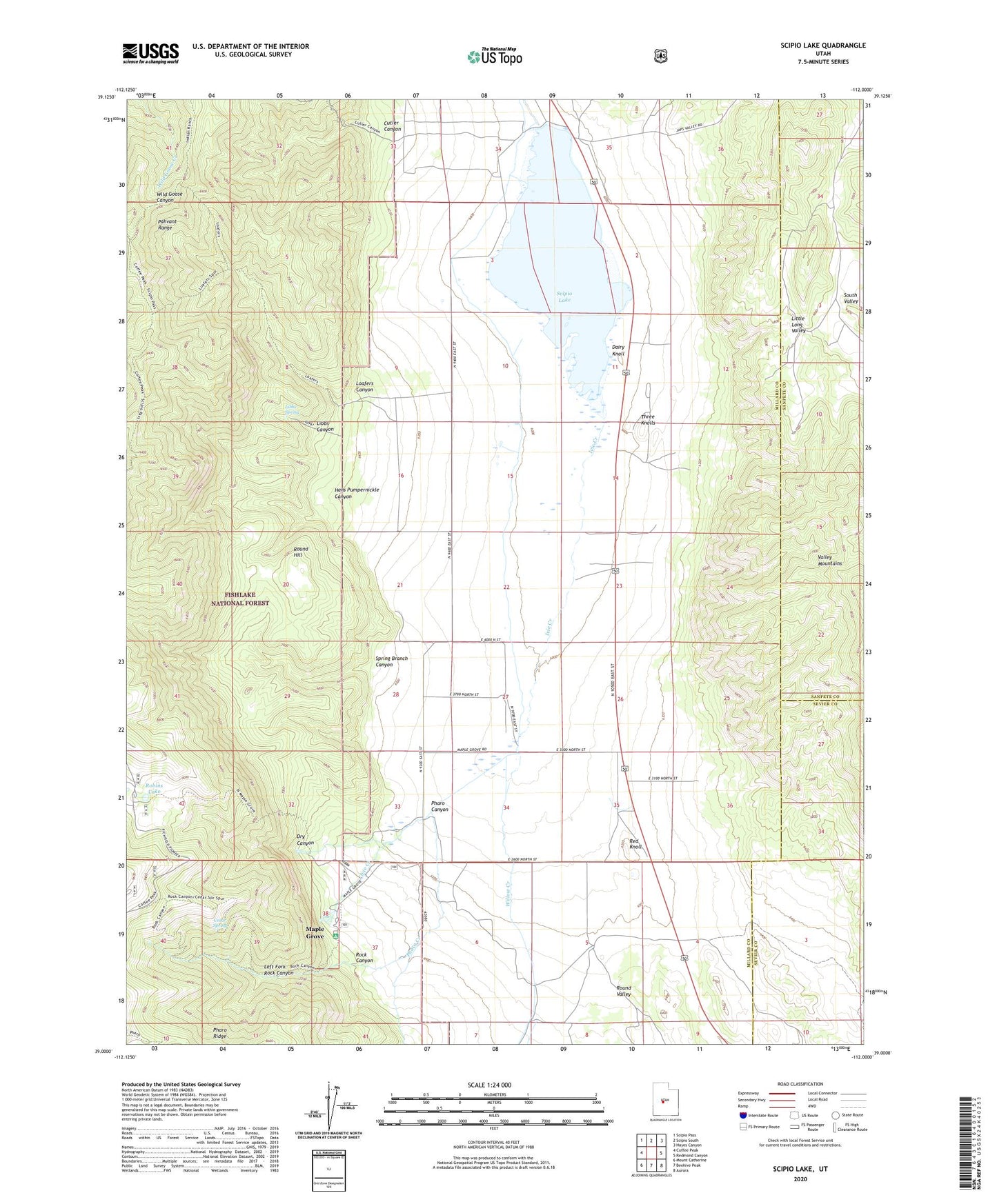
Scipio Lake Utah US Topo Map
Couldn't load pickup availability
Also explore the Scipio Lake Forest Service Topo of this same quad for updated USFS data
2023 topographic map quadrangle Scipio Lake in the state of Utah. Scale: 1:24000. Based on the newly updated USGS 7.5' US Topo map series, this map is in the following counties: Millard, Sanpete, Sevier. The map contains contour data, water features, and other items you are used to seeing on USGS maps, but also has updated roads and other features. This is the next generation of topographic maps. Printed on high-quality waterproof paper with UV fade-resistant inks.
Quads adjacent to this one:
West: Coffee Peak
Northwest: Scipio Pass
North: Scipio South
Northeast: Hayes Canyon
East: Redmond Canyon
Southeast: Aurora
South: Beehive Peak
Southwest: Mount Catherine
This map covers the same area as the classic USGS quad with code o39112a1.
Contains the following named places: Cedar Spring, Cutler Canyon, Dairy Knoll, David Norris Spring, Dry Canyon, Hans Pumpernickle Canyon, Ivie Creek, Left Fork Rock Canyon, Libbs Canyon, Libbs Spring, Little Long Valley, Loafers Canyon, Maple Grove, Maple Grove Campground, Pharo Creek, Pharo Ridge, Red Knoll, Robins Lake, Rock Canyon, Round Hill, Scipio Lake, Scipio Lake Dam, Spring Branch Canyon, Three Knolls, Willow Creek