MyTopo
Bible Spring Utah US Topo Map
Couldn't load pickup availability
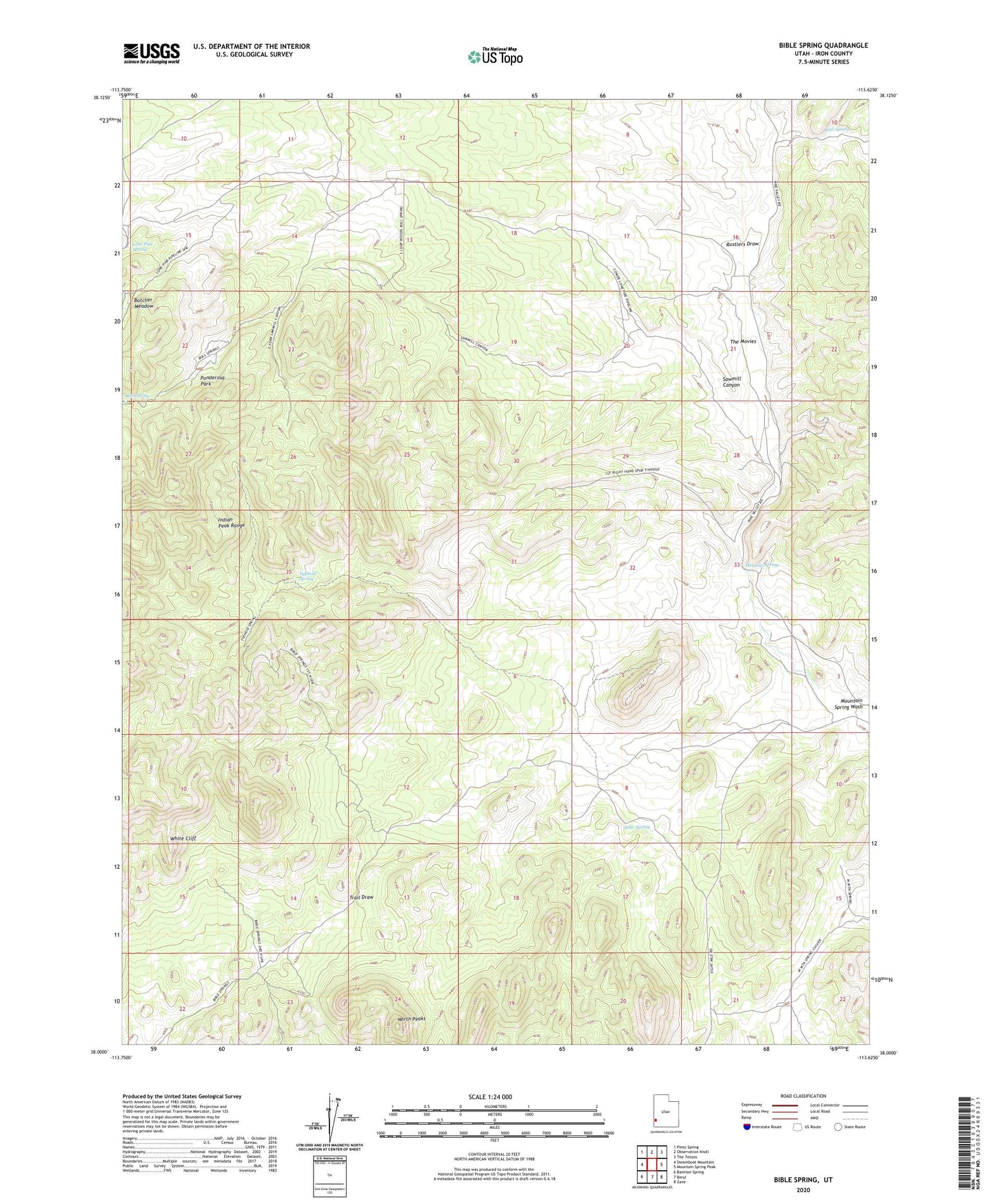
2020 topographic map quadrangle Bible Spring in the state of Utah. Scale: 1:24000. Based on the newly updated USGS 7.5' US Topo map series, this map is in the following counties: Iron. The map contains contour data, water features, and other items you are used to seeing on USGS maps, but also has updated roads and other features. This is the next generation of topographic maps. Printed on high-quality waterproof paper with UV fade-resistant inks.
Quads adjacent to this one:
West: Steamboat Mountain
Northwest: Pinto Spring
North: Observation Knoll
Northeast: The Tetons
East: Mountain Spring Peak
Southeast: Zane
South: Beryl
Southwest: Bannion Spring
Contains the following named places: Bible Spring, Bull Spring, Butcher Meadow, Butcher Spring, Keel Spring, Lone Pine Spring, Meadow Spring, North Peaks, Ponderosa Park, Rustlers Draw, Sawmill Canyon, The Movies, Typhoid Spring, White Cliff