MyTopo
Steamboat Mountain Utah US Topo Map
Couldn't load pickup availability
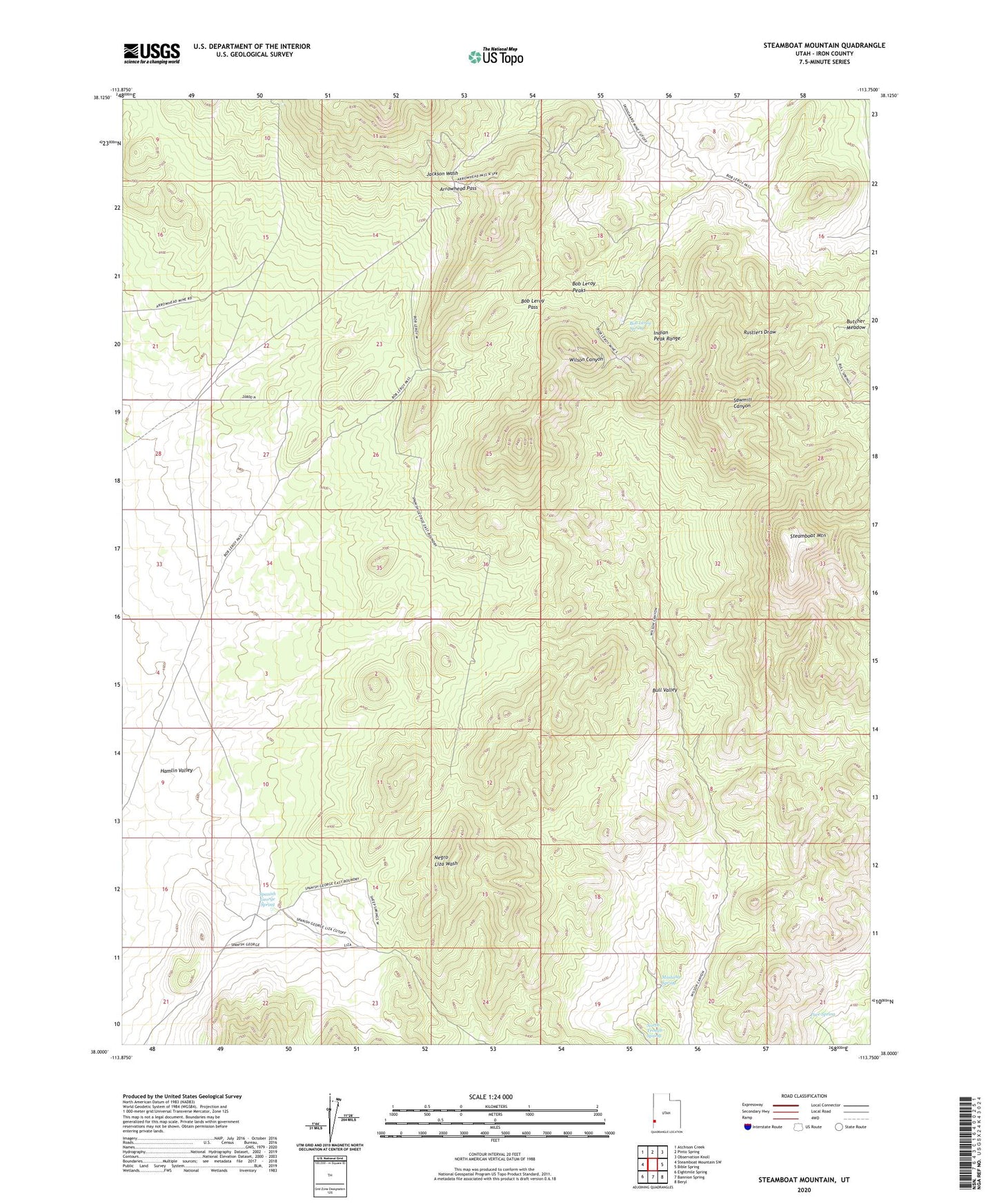
2023 topographic map quadrangle Steamboat Mountain in the state of Utah. Scale: 1:24000. Based on the newly updated USGS 7.5' US Topo map series, this map is in the following counties: Iron. The map contains contour data, water features, and other items you are used to seeing on USGS maps, but also has updated roads and other features. This is the next generation of topographic maps. Printed on high-quality waterproof paper with UV fade-resistant inks.
Quads adjacent to this one:
West: Steamboat Mountain SW
Northwest: Atchison Creek
North: Pinto Spring
Northeast: Observation Knoll
East: Bible Spring
Southeast: Beryl
South: Bannion Spring
Southwest: Eightmile Spring
This map covers the same area as the classic USGS quad with code o38113a7.
Contains the following named places: Arrowhead Pass, Bob Leroy Pass, Bob Leroy Peaks, Bob Leroy Spring, Bull Valley, Mustang Spring, North Trough Spring, Pace Spring, Pipeline Spring Trough, Skougard Mine, Spanish George Spring, Steamboat Mountain