MyTopo
Big Water Utah US Topo Map
Couldn't load pickup availability
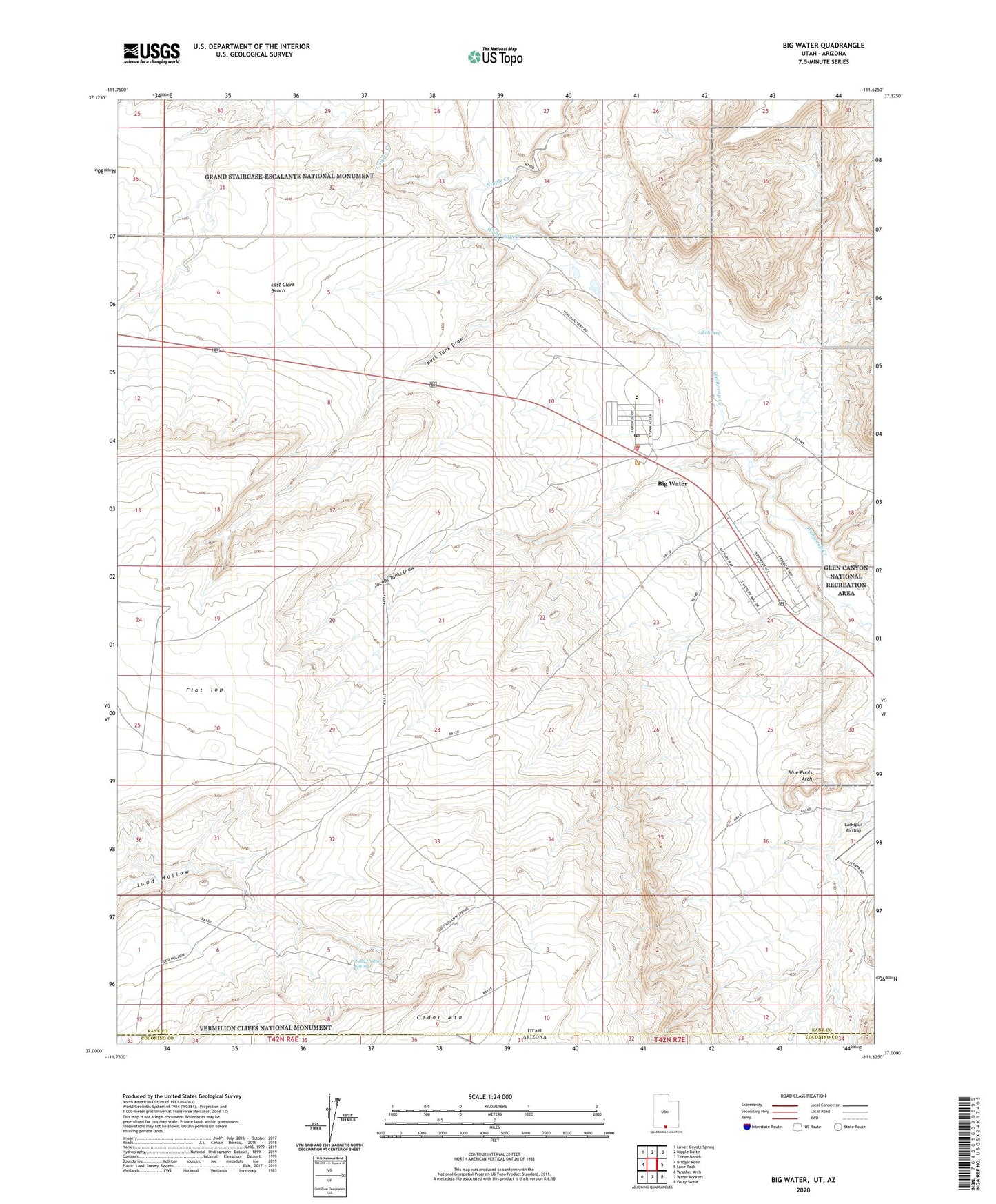
2023 topographic map quadrangle Big Water in the state of Utah. Scale: 1:24000. Based on the newly updated USGS 7.5' US Topo map series, this map is in the following counties: Kane, Coconino. The map contains contour data, water features, and other items you are used to seeing on USGS maps, but also has updated roads and other features. This is the next generation of topographic maps. Printed on high-quality waterproof paper with UV fade-resistant inks.
Quads adjacent to this one:
West: Bridger Point
Northwest: Lower Coyote Spring
North: Nipple Butte
Northeast: Tibbet Bench
East: Lone Rock
Southeast: Ferry Swale
South: Water Pockets
Southwest: Wrather Arch
Contains the following named places: Alkali Seep, Big Water, Big Water Fire Department, Big Water Post Office, Blue Pools Arch, Buck Tank Draw, Coyote Creek, Jacobs Tanks, Jacobs Tanks Draw, Judd Hollow Spring, Kane County Ambulance - Big Water, Larkspur Airstrip, Nipple Creek, Town of Big Water