MyTopo
Nipple Butte Utah US Topo Map
Couldn't load pickup availability
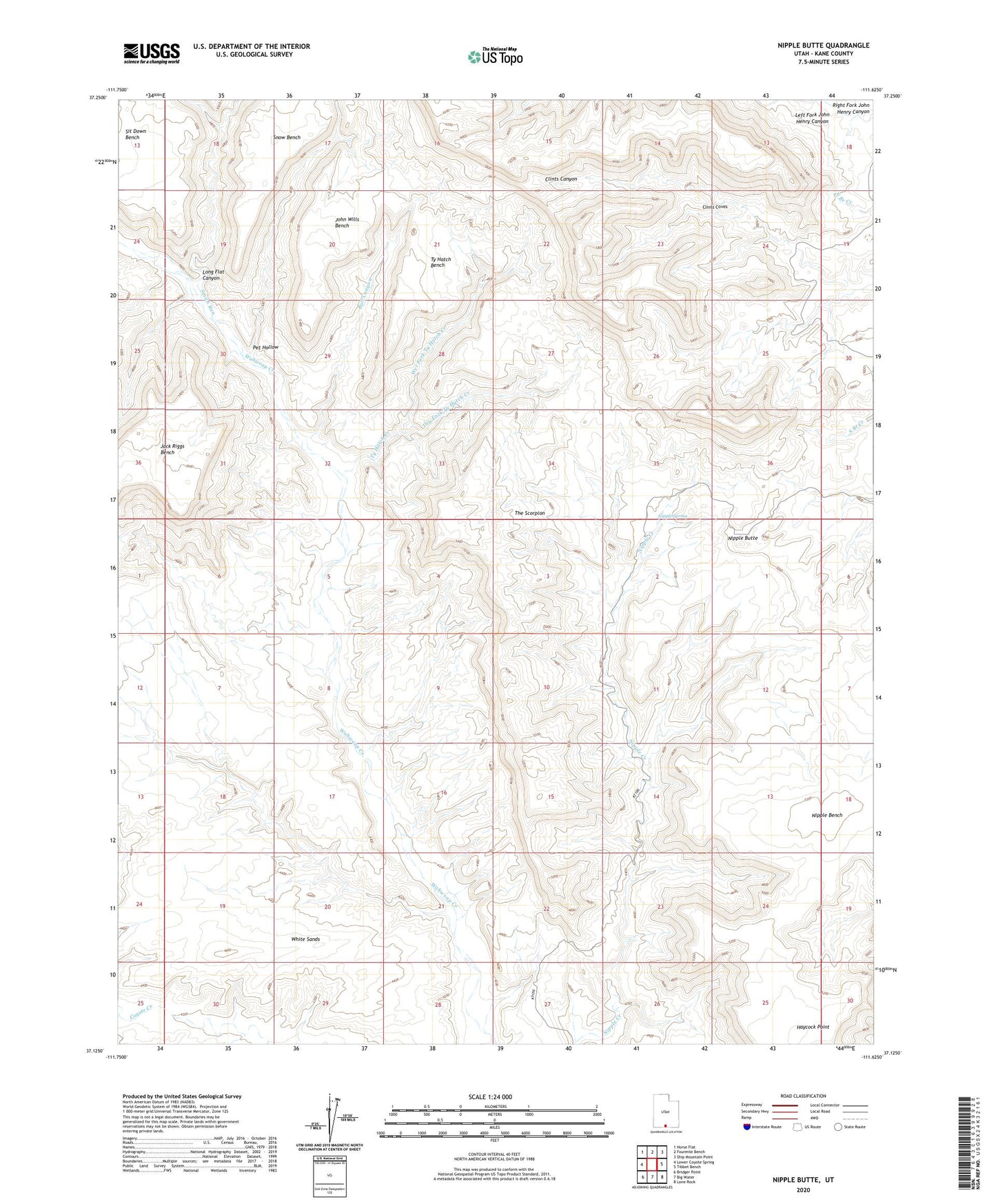
2023 topographic map quadrangle Nipple Butte in the state of Utah. Scale: 1:24000. Based on the newly updated USGS 7.5' US Topo map series, this map is in the following counties: Kane. The map contains contour data, water features, and other items you are used to seeing on USGS maps, but also has updated roads and other features. This is the next generation of topographic maps. Printed on high-quality waterproof paper with UV fade-resistant inks.
Quads adjacent to this one:
West: Lower Coyote Spring
Northwest: Horse Flat
North: Fourmile Bench
Northeast: Ship Mountain Point
East: Tibbet Bench
Southeast: Lone Rock
South: Big Water
Southwest: Bridger Point
This map covers the same area as the classic USGS quad with code o37111b6.
Contains the following named places: Bull Canyon, Clints Coves, Dry Fork Ty Hatch Creek, Haycock Point, Jack Riggs Bench, John Wills Bench, Long Flat Canyon, Nipple Butte, Nipple Spring, Pet Hollow, Sit Down Bench, Smith Run, Snow Bench, The Scorpion, Ty Hatch Bench, Ty Hatch Creek, Wet Fork Ty Hatch Creek, White Sands