MyTopo
Black Point Utah US Topo Map
Couldn't load pickup availability
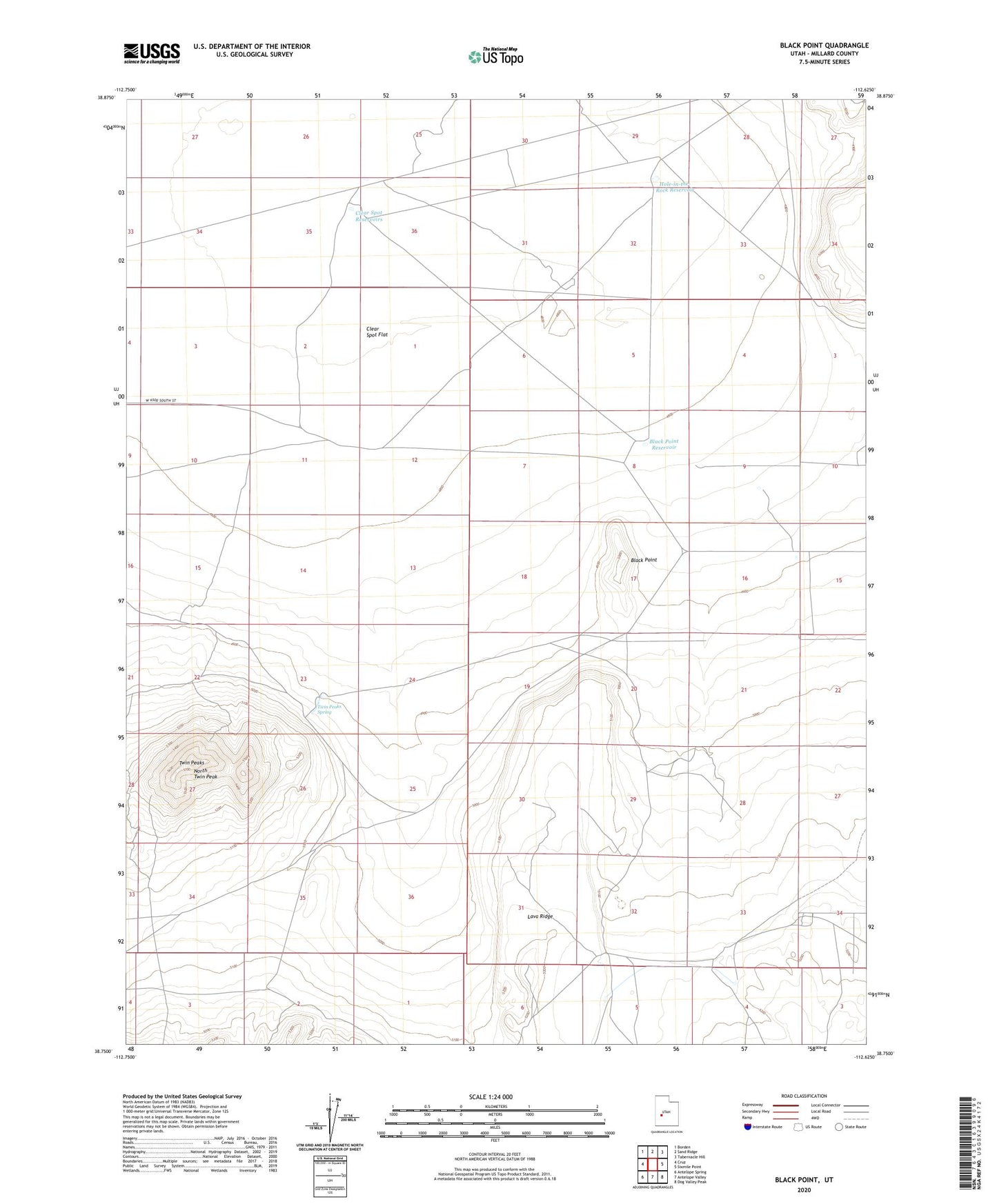
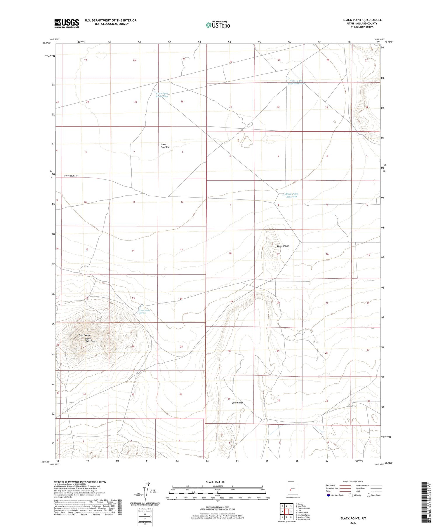
2020 topographic map quadrangle Black Point in the state of Utah. Scale: 1:24000. Based on the newly updated USGS 7.5' US Topo map series, this map is in the following counties: Millard. The map contains contour data, water features, and other items you are used to seeing on USGS maps, but also has updated roads and other features. This is the next generation of topographic maps. Printed on high-quality waterproof paper with UV fade-resistant inks.
Quads adjacent to this one:
West: Cruz
Northwest: Borden
North: Sand Ridge
Northeast: Tabernacle Hill
East: Sixmile Point
Southeast: Dog Valley Peak
South: Antelope Valley
Southwest: Antelope Spring
Contains the following named places: Black Point, Black Point Reservoir, Clear Spot Flat, Clear Spot Reservoirs, Hole-in-the-Rock Reservoir, Lava Ridge, North Twin Peak, Twin Peaks, Twin Peaks Spring