MyTopo
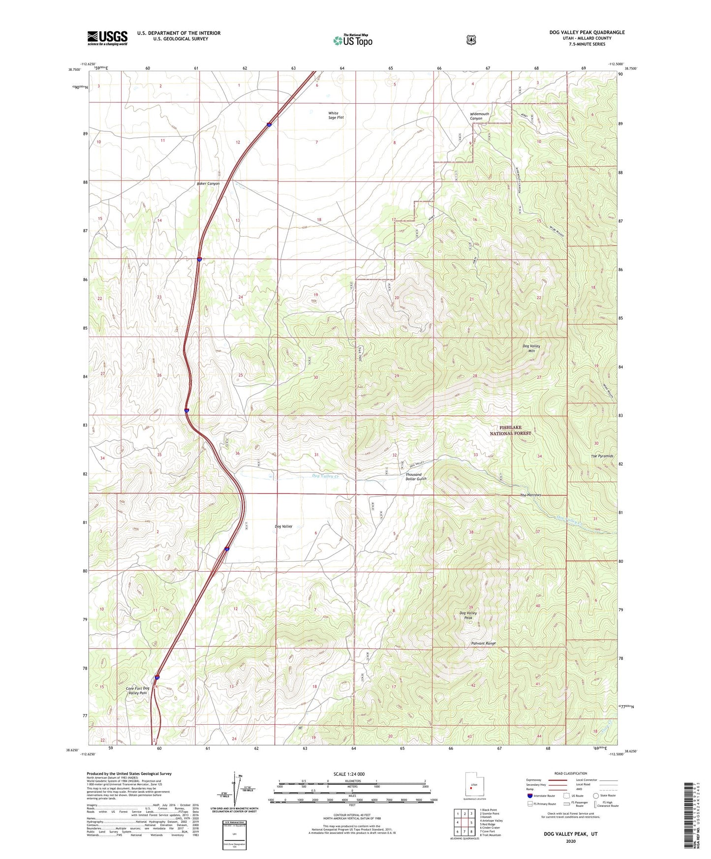
Dog Valley Peak Utah US Topo Map
Couldn't load pickup availability
Also explore the Dog Valley Peak Forest Service Topo of this same quad for updated USFS data
2023 topographic map quadrangle Dog Valley Peak in the state of Utah. Scale: 1:24000. Based on the newly updated USGS 7.5' US Topo map series, this map is in the following counties: Millard. The map contains contour data, water features, and other items you are used to seeing on USGS maps, but also has updated roads and other features. This is the next generation of topographic maps. Printed on high-quality waterproof paper with UV fade-resistant inks.
Quads adjacent to this one:
West: Antelope Valley
Northwest: Black Point
North: Sixmile Point
Northeast: Kanosh
East: Red Ridge
Southeast: Trail Mountain
South: Cove Fort
Southwest: Cinder Crater
This map covers the same area as the classic USGS quad with code o38112f5.
Contains the following named places: Baker Canyon, Cove Fort Dog Valley Pass, Dog Valley, Dog Valley Creek, Dog Valley Mountain, Dog Valley Peak, Jewkes Mine, Purple Sage Mine, The Narrows, Thousand Dollar Gulch, White Sage Flat, Widemouth Canyon, ZIP Code: 84637