MyTopo
Tabernacle Hill Utah US Topo Map
Couldn't load pickup availability
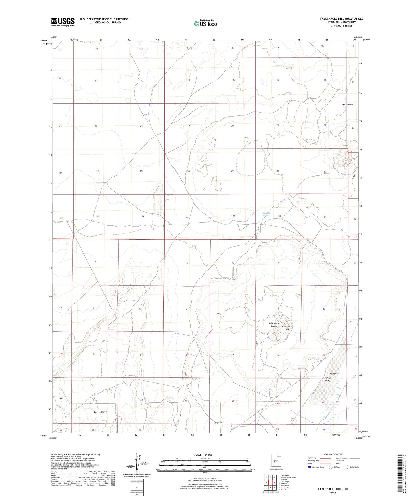
2023 topographic map quadrangle Tabernacle Hill in the state of Utah. Scale: 1:24000. Based on the newly updated USGS 7.5' US Topo map series, this map is in the following counties: Millard. The map contains contour data, water features, and other items you are used to seeing on USGS maps, but also has updated roads and other features. This is the next generation of topographic maps. Printed on high-quality waterproof paper with UV fade-resistant inks.
Quads adjacent to this one:
West: Sand Ridge
Northwest: Clear Lake
North: Pahvant Butte South
Northeast: The Sink
East: Meadow
Southeast: Kanosh
South: Sixmile Point
Southwest: Black Point
This map covers the same area as the classic USGS quad with code o38112h5.
Contains the following named places: Beaver Ridge, Clay Flat, Fillmore Division, Jacobs Well, Mud Lake, Squidike Spring, Tabernacle Crater, Tabernacle Hill, The Cinders