
MyTopo
Black Table Utah US Topo Map
Couldn't load pickup availability
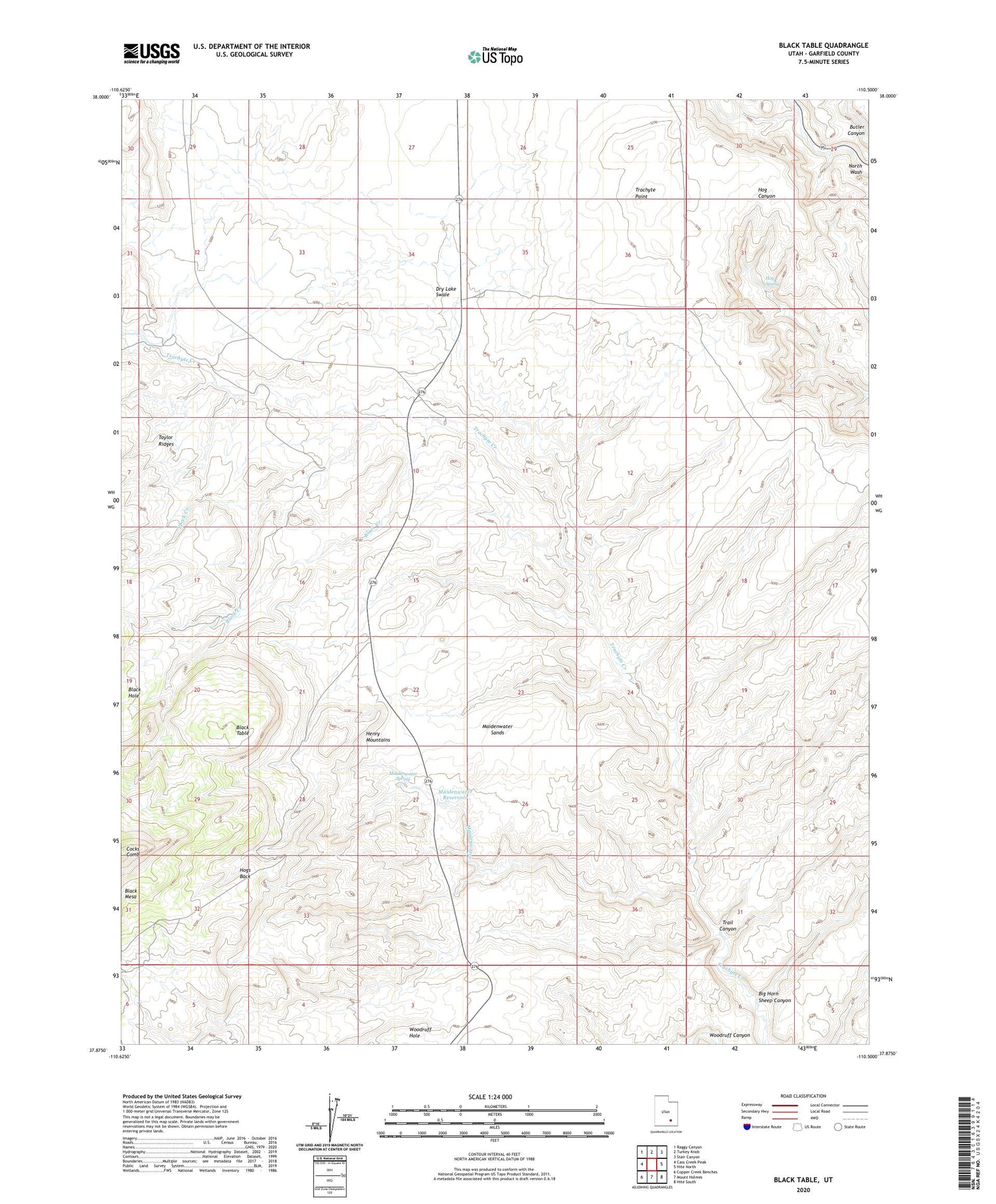
2020 topographic map quadrangle Black Table in the state of Utah. Scale: 1:24000. Based on the newly updated USGS 7.5' US Topo map series, this map is in the following counties: Garfield. The map contains contour data, water features, and other items you are used to seeing on USGS maps, but also has updated roads and other features. This is the next generation of topographic maps. Printed on high-quality waterproof paper with UV fade-resistant inks.
Quads adjacent to this one:
West: Cass Creek Peak
Northwest: Raggy Canyon
North: Turkey Knob
Northeast: Stair Canyon
East: Hite North
Southeast: Hite South
South: Mount Holmes
Southwest: Copper Creek Benches
Contains the following named places: Big Horn Sheep Canyon, Black Creek, Black Table, Hog Spring, Hog Springs Campground, Hogs Back, Maidenwater, Maidenwater Reservoir, Maidenwater Sands, Maidenwater Spring, Speck Creek, Trachyte Ranch, Trail Canyon


