MyTopo
Hite South Utah US Topo Map
Couldn't load pickup availability
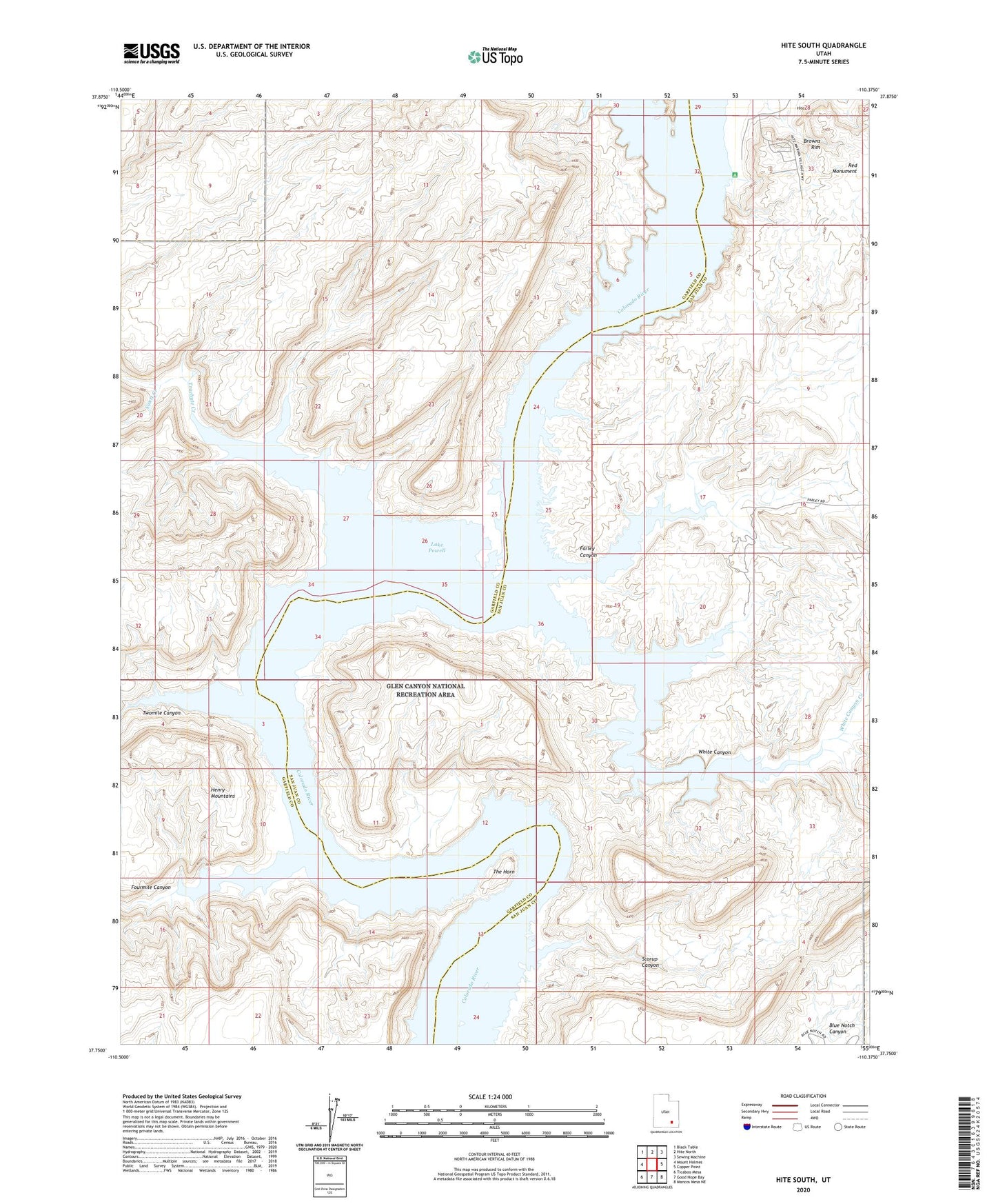
2023 topographic map quadrangle Hite South in the state of Utah. Scale: 1:24000. Based on the newly updated USGS 7.5' US Topo map series, this map is in the following counties: San Juan, Garfield. The map contains contour data, water features, and other items you are used to seeing on USGS maps, but also has updated roads and other features. This is the next generation of topographic maps. Printed on high-quality waterproof paper with UV fade-resistant inks.
Quads adjacent to this one:
West: Mount Holmes
Northwest: Black Table
North: Hite North
Northeast: Sewing Machine
East: Copper Point
Southeast: Mancos Mesa NE
South: Good Hope Bay
Southwest: Ticaboo Mesa
This map covers the same area as the classic USGS quad with code o37110g4.
Contains the following named places: Dandy Crossing, Farley Canyon, Fourmile Canyon, Hite, Hite Marina, Hite Marina Campground, North Wash, Red Monument, Scorup Canyon, Swett Creek, The Horn, Trachyte Creek, Twomile Canyon, White Canyon, White Canyon Creek