MyTopo
Raggy Canyon Utah US Topo Map
Couldn't load pickup availability
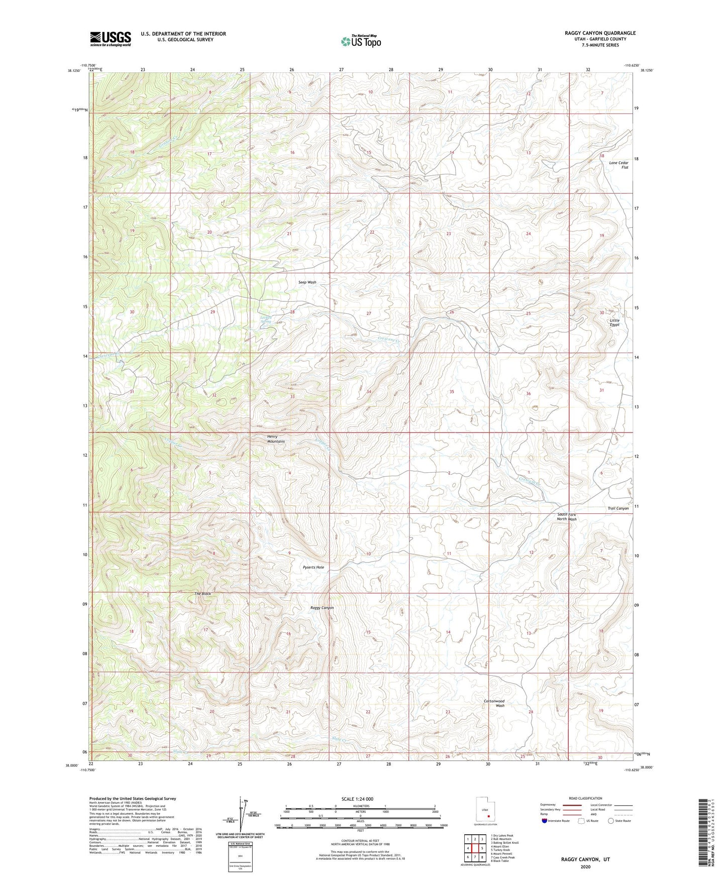
2023 topographic map quadrangle Raggy Canyon in the state of Utah. Scale: 1:24000. Based on the newly updated USGS 7.5' US Topo map series, this map is in the following counties: Garfield. The map contains contour data, water features, and other items you are used to seeing on USGS maps, but also has updated roads and other features. This is the next generation of topographic maps. Printed on high-quality waterproof paper with UV fade-resistant inks.
Quads adjacent to this one:
West: Mount Ellen
Northwest: Dry Lakes Peak
North: Bull Mountain
Northeast: Baking Skillet Knoll
East: Turkey Knob
Southeast: Black Table
South: Cass Creek Peak
Southwest: Mount Pennell
This map covers the same area as the classic USGS quad with code o38110a6.
Contains the following named places: Copper Creek, Crescent Creek, Eagle City, Lecleed Spring, Little Egypt, Little Egypt Geologic Site, Pyserts Hole, Raggy Canyon, South Fork North Wash, The Block, Trail Canyon