MyTopo
Blue Mountain Utah US Topo Map
Couldn't load pickup availability
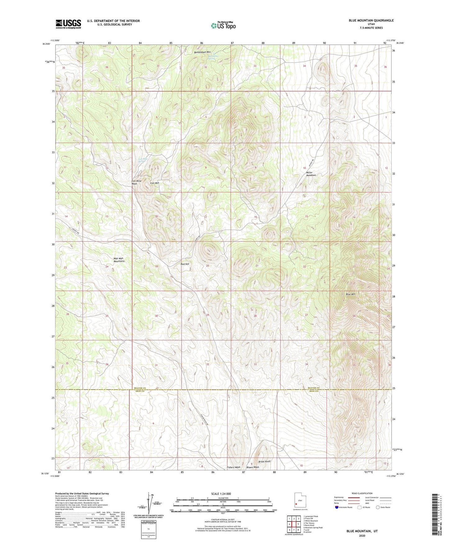
2023 topographic map quadrangle Blue Mountain in the state of Utah. Scale: 1:24000. Based on the newly updated USGS 7.5' US Topo map series, this map is in the following counties: Beaver, Iron. The map contains contour data, water features, and other items you are used to seeing on USGS maps, but also has updated roads and other features. This is the next generation of topographic maps. Printed on high-quality waterproof paper with UV fade-resistant inks.
Quads adjacent to this one:
West: The Tetons
Northwest: Lamerdorf Peak
North: Frisco SW
Northeast: White Mountain
East: Burns Knoll
Southeast: Latimer
South: Lund
Southwest: Mountain Spring Peak
This map covers the same area as the classic USGS quad with code o38113b4.
Contains the following named places: Blue Mountain, Bumblebee Mountain, Bumblebee Spring, Iron Mine Spring, Iron Mine Wash, Iron Mountain, McKnights Well, Miller Meadows, Red Hill