MyTopo
White Mountain Utah US Topo Map
Couldn't load pickup availability
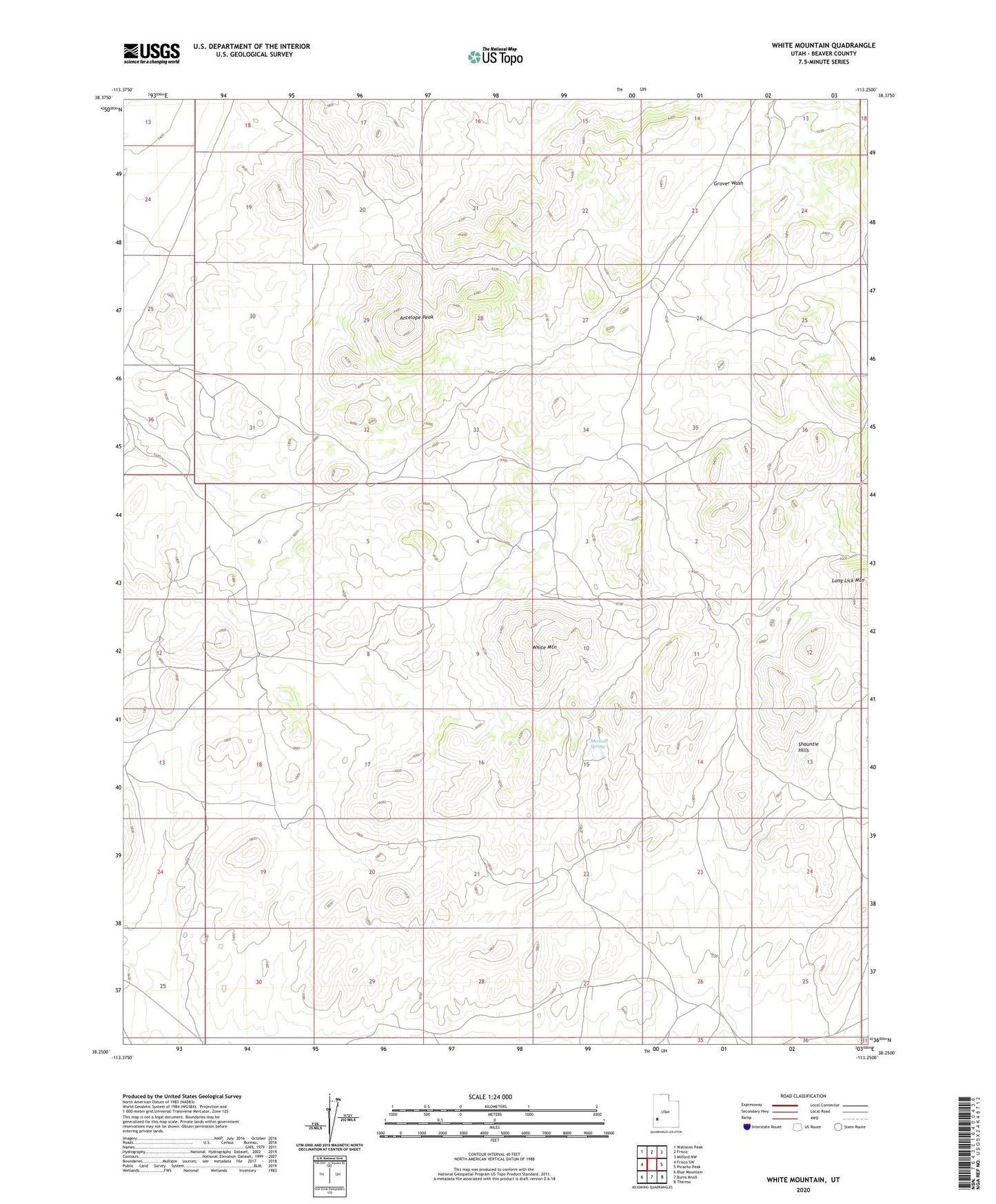
2023 topographic map quadrangle White Mountain in the state of Utah. Scale: 1:24000. Based on the newly updated USGS 7.5' US Topo map series, this map is in the following counties: Beaver. The map contains contour data, water features, and other items you are used to seeing on USGS maps, but also has updated roads and other features. This is the next generation of topographic maps. Printed on high-quality waterproof paper with UV fade-resistant inks.
Quads adjacent to this one:
West: Frisco SW
Northwest: Wallaces Peak
North: Frisco
Northeast: Milford NW
East: Picacho Peak
Southeast: Thermo
South: Burns Knoll
Southwest: Blue Mountain
This map covers the same area as the classic USGS quad with code o38113c3.
Contains the following named places: Antelope Peak, Mertons Spring, Seveys Well, White Mountain