MyTopo
Brigham City Utah US Topo Map
Couldn't load pickup availability
Also explore the Brigham City Forest Service Topo of this same quad for updated USFS data
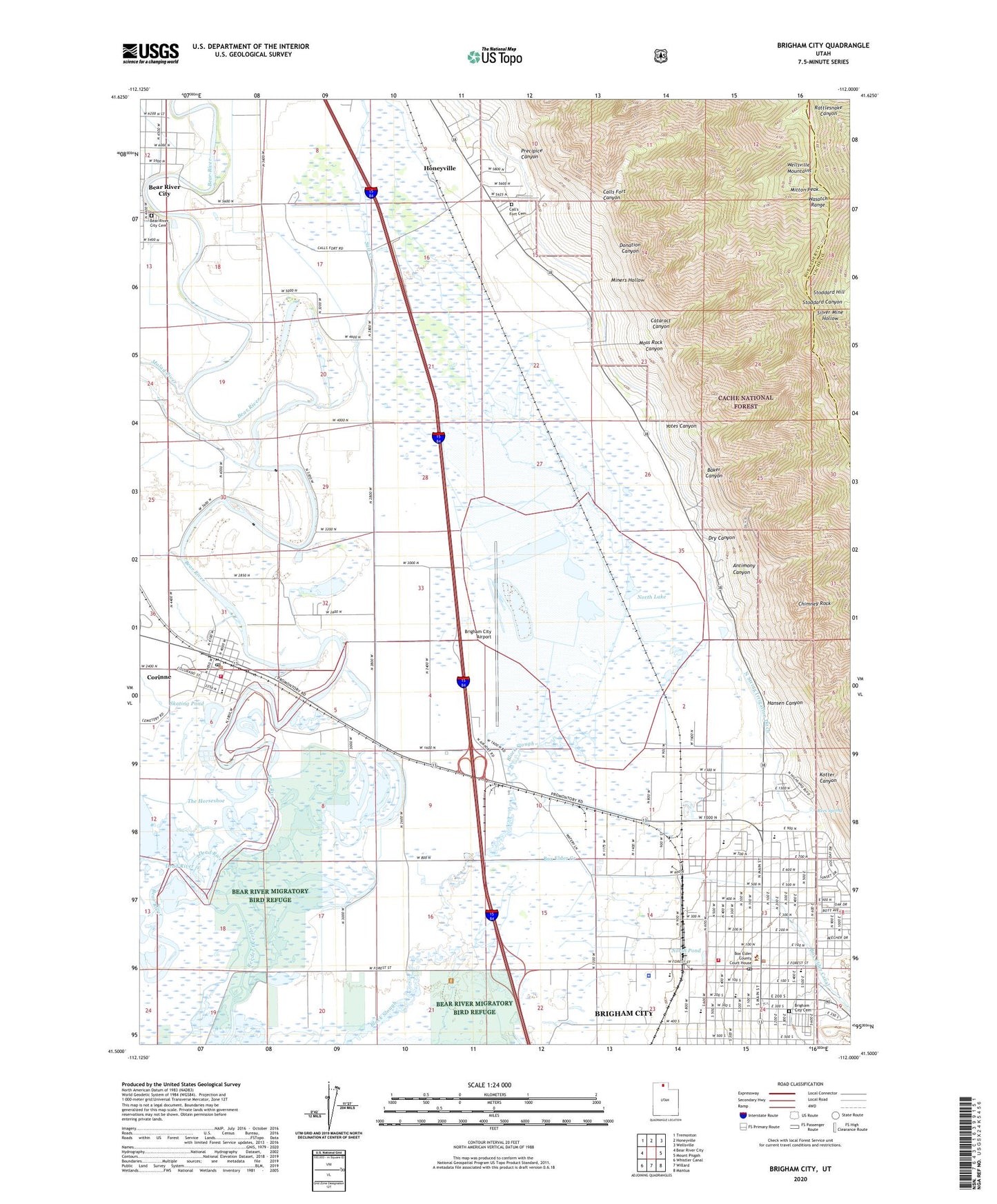
2023 topographic map quadrangle Brigham City in the state of Utah. Scale: 1:24000. Based on the newly updated USGS 7.5' US Topo map series, this map is in the following counties: Box Elder, Cache. The map contains contour data, water features, and other items you are used to seeing on USGS maps, but also has updated roads and other features. This is the next generation of topographic maps. Printed on high-quality waterproof paper with UV fade-resistant inks.
Quads adjacent to this one:
West: Bear River City
Northwest: Tremonton
North: Honeyville
Northeast: Wellsville
East: Mount Pisgah
Southeast: Mantua
South: Willard
Southwest: Whistler Canal
This map covers the same area as the classic USGS quad with code o41112e1.
Contains the following named places: Antimony Canyon, Asemblea de Dios, Baker Canyon, Baker Mine, Bear River City Cemetery, Box Elder Canal, Box Elder County Sheriff's Office, Box Elder Creek, Box Elder Middle School, Brigham City, Brigham City Airport, Brigham City Cemetery, Brigham City Country Club, Brigham City Fire Department, Brigham City Police Department, Brigham City Post Office, Brigham Young Park, Bunderson School, Calls Fort, Calls Fort Canyon, Call's Fort Cemetery, Calls Fort Monument, Cataract Canyon, Cement Ponds, Central School, Chimney Rock, Church of Christ, City of Bear River City, City of Brigham City, City of Corinne, Community Presbyterian Church, Cooley Well, Copper Blossom Mine, Corinne, Corinne Early Learning Center, Corinne Fire Department, Corinne Post Office, Dead River, Donation Canyon, Dry Canyon, First Baptist Church, Foothill Elementary School, Hansen Canyon, Holy Cross Lutheran Church, Horseshoe Sloughs, KBUH-AM (Brigham City), KBUH-FM (Brigham City), Kotter Canyon, Lincoln School, Malad River, Mallard Pond, Mill Run, Miners Hollow, Mitton Peak, Moss Rock Canyon, North Lake, North Pond, North String Irrigation Ditch, Precipice Canyon, Rees Park, Rees Spring, Salt Creek, Skating Pond, South Pond, Stoddard Hill, The Church of Jesus Christ of Latter Day Saints, The Horseshoe, Utah Highway Patrol Section 1 Brigham City Office, Yates Canyon, ZIP Code: 84302