MyTopo
Tremonton Utah US Topo Map
Couldn't load pickup availability
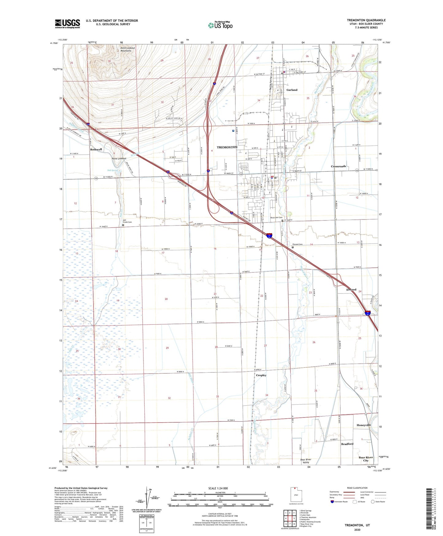
2023 topographic map quadrangle Tremonton in the state of Utah. Scale: 1:24000. Based on the newly updated USGS 7.5' US Topo map series, this map is in the following counties: Box Elder. The map contains contour data, water features, and other items you are used to seeing on USGS maps, but also has updated roads and other features. This is the next generation of topographic maps. Printed on high-quality waterproof paper with UV fade-resistant inks.
Quads adjacent to this one:
West: Thatcher Mountain
Northwest: Blind Springs
North: Riverside
Northeast: Cutler Dam
East: Honeyville
Southeast: Brigham City
South: Bear River City
Southwest: Public Shooting Grounds
This map covers the same area as the classic USGS quad with code o41112f2.
Contains the following named places: Bear River High School, Bear River Middle School, Bear River Valley Heliport, Bear River Valley Hospital, Bradford, Bush, Central Canal, City of Garland, City of Tremonton, Corinne Canal, Cropley, Crossroads, Doutres Mobile Home Park, Elwood, Elwood Cemetery, Elwood School, Garland, Garland Fire Department, Garland Police Department, Garland Post Office, Highline Canal, Jack's Airport, KBXN-AM (Tremonton), McKinley Elementary School, Mill Ditch, North Park Elementary School, Point Lookout, Point Lookout Mountains, Riverview Cemetery, Salt Creek, Salt Creek Cemetery, Salt Spring, The Church of Jesus Christ of Latter Day Saints, Town of Elwood, Tremonton, Tremonton Fire Department, Tremonton Police Department, Tremonton Post Office