MyTopo
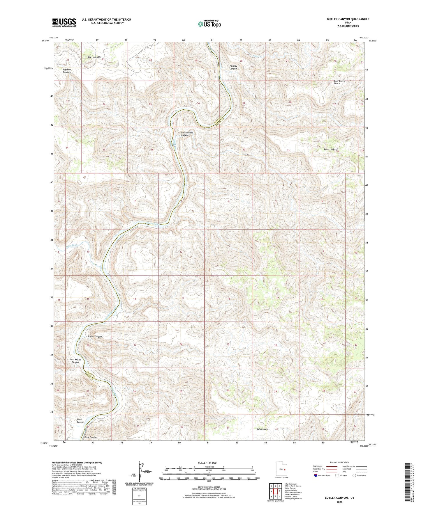
Butler Canyon Utah US Topo Map
Couldn't load pickup availability
2023 topographic map quadrangle Butler Canyon in the state of Utah. Scale: 1:24000. Based on the newly updated USGS 7.5' US Topo map series, this map is in the following counties: Grand, Emery. The map contains contour data, water features, and other items you are used to seeing on USGS maps, but also has updated roads and other features. This is the next generation of topographic maps. Printed on high-quality waterproof paper with UV fade-resistant inks.
Quads adjacent to this one:
West: Jenny Canyon
Northwest: Turtle Canyon
North: Three Fords Canyon
Northeast: Lion Canyon
East: Bobby Canyon North
Southeast: Bobby Canyon South
South: Tusher Canyon
Southwest: Blue Castle Butte
This map covers the same area as the classic USGS quad with code o39110b1.
Contains the following named places: Big Horn Benches, Big Horn Mountain, Butler Canyon, Coal Creek Bench, Poverty Bench, Poverty Canyon, Price River, Rattlesnake Canyon, Sand Knolls Canyon, Short Canyon, Suluar Mesa