MyTopo
Tusher Canyon Utah US Topo Map
Couldn't load pickup availability
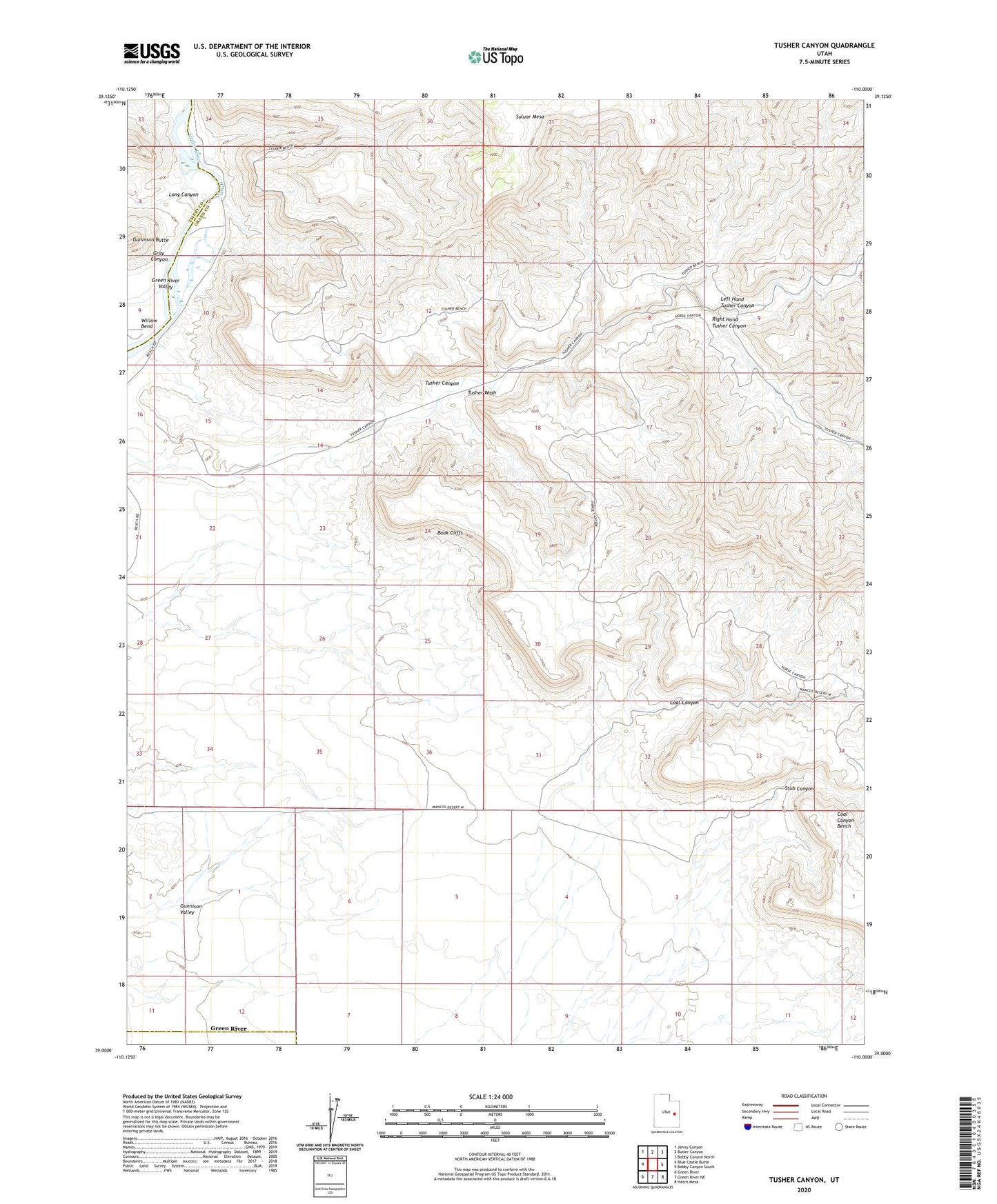
2023 topographic map quadrangle Tusher Canyon in the state of Utah. Scale: 1:24000. Based on the newly updated USGS 7.5' US Topo map series, this map is in the following counties: Grand, Emery. The map contains contour data, water features, and other items you are used to seeing on USGS maps, but also has updated roads and other features. This is the next generation of topographic maps. Printed on high-quality waterproof paper with UV fade-resistant inks.
Quads adjacent to this one:
West: Blue Castle Butte
Northwest: Jenny Canyon
North: Butler Canyon
Northeast: Bobby Canyon North
East: Bobby Canyon South
Southeast: Hatch Mesa
South: Green River NE
Southwest: Green River
This map covers the same area as the classic USGS quad with code o39110a1.
Contains the following named places: Coal Canyon, Gray Canyon, Green River Valley, Gunnison Butte, Gunnison Valley, Left Hand Tusher Canyon, Long Canyon, Right Hand Tusher Canyon, Stub Canyon, Tusher Canyon, ZIP Code: 84525