
MyTopo
Bybee Knoll Utah US Topo Map
Couldn't load pickup availability
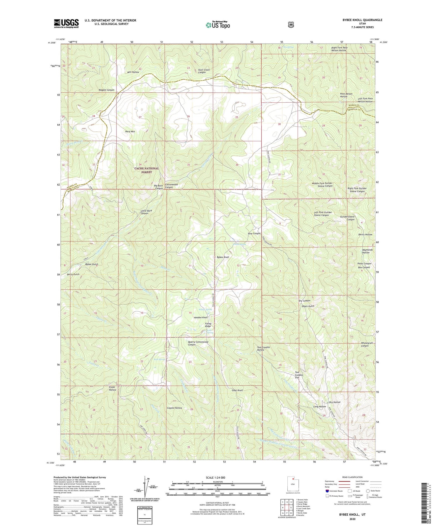
2020 topographic map quadrangle Bybee Knoll in the state of Utah. Scale: 1:24000. Based on the newly updated USGS 7.5' US Topo map series, this map is in the following counties: Morgan, Weber. The map contains contour data, water features, and other items you are used to seeing on USGS maps, but also has updated roads and other features. This is the next generation of topographic maps. Printed on high-quality waterproof paper with UV fade-resistant inks.
Quads adjacent to this one:
West: Durst Mountain
Northwest: Browns Hole
North: Causey Dam
Northeast: Horse Ridge
East: Lost Creek Dam
Southeast: Henefer
South: Devils Slide
Southwest: Morgan
Contains the following named places: Berry Gulch, Big Buck Canyon, Black Gulch, Box Canyon, Box Spring, Bybee Creek, Bybee Gulch, Bybee Knoll, Cold Spring, Cordwood Creek, Devils Hollow, Dry Canyon, Dry Hollow, Folley Ridge, Goat Knoll, Herd Mountain, Hoodoo Knoll, Left Fork Guilder Sleeve Canyon, Little Buck Canyon, Long Hollow, Maggie Hopkins Cottonwood Creek, Middle Fork Guilder Sleeve Canyon, Morgan North Division, Petes Canyon, Raymonds Hollow, Right Fork Guilder Sleeve Canyon, Right Fork Pete Nelson Hollow, Right Hand Fork Bybee Creek, Rock Spring, Tom Condies Flat, Tom Condies Hollow, Willow Spring


