MyTopo
Henefer Utah US Topo Map
Couldn't load pickup availability
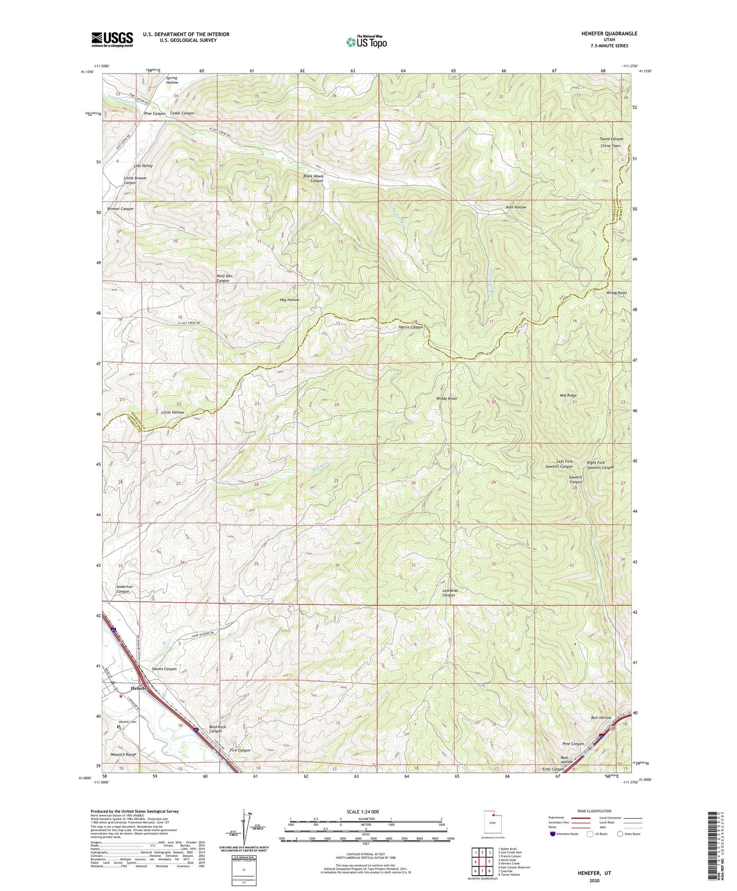
2023 topographic map quadrangle Henefer in the state of Utah. Scale: 1:24000. Based on the newly updated USGS 7.5' US Topo map series, this map is in the following counties: Summit, Morgan. The map contains contour data, water features, and other items you are used to seeing on USGS maps, but also has updated roads and other features. This is the next generation of topographic maps. Printed on high-quality waterproof paper with UV fade-resistant inks.
Quads adjacent to this one:
West: Devils Slide
Northwest: Bybee Knoll
North: Lost Creek Dam
Northeast: Francis Canyon
East: Heiners Creek
Southeast: Turner Hollow
South: Coalville
Southwest: East Canyon Reservoir
This map covers the same area as the classic USGS quad with code o41111a4.
Contains the following named places: Anderton Canyon, Bald Rock Canyon, Bear Hollow, Big Pine Fork, Black Hawk Canyon, Brewer Canyon, Bull Hollow, Cedar Canyon, China Town, Fire Canyon, Henefer, Henefer Cemetery, Henefer Post Office, Henefer-Echo Wildlife Management Area, Left Fork Sawmill Canyon, Little Brewer Canyon, Little Pine Fork, Middle Ridge, North Summit EMS Ambulance, North Summit Fire District Station 22 Henefer, Owens Canyon, Pine Canyon, Pole Hollow, Red Fork, Right Fork Sawmill Canyon, The Church of Jesus Christ of Latter Day Saints, Tom Condies Creek, Town of Henefer, Windy Knoll, ZIP Code: 84024