MyTopo
Morgan Utah US Topo Map
Couldn't load pickup availability
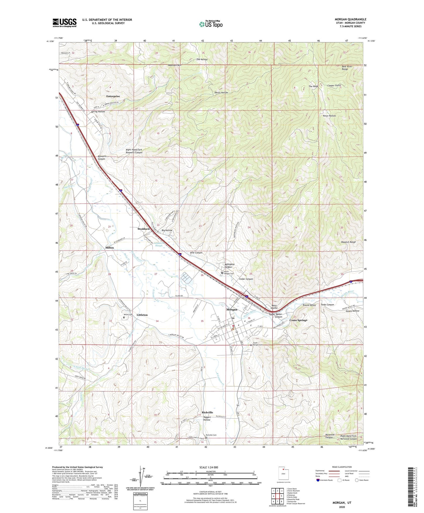
2023 topographic map quadrangle Morgan in the state of Utah. Scale: 1:24000. Based on the newly updated USGS 7.5' US Topo map series, this map is in the following counties: Morgan. The map contains contour data, water features, and other items you are used to seeing on USGS maps, but also has updated roads and other features. This is the next generation of topographic maps. Printed on high-quality waterproof paper with UV fade-resistant inks.
Quads adjacent to this one:
West: Peterson
Northwest: Snow Basin
North: Durst Mountain
Northeast: Bybee Knoll
East: Devils Slide
Southeast: East Canyon Reservoir
South: Porterville
Southwest: Bountiful Peak
This map covers the same area as the classic USGS quad with code o41111a6.
Contains the following named places: Big Hollow, Cedar Canyon, Center Fork Deep Creek, City of Morgan, Como Diversion, Como Springs, Dalton Creek, Deep Creek, Devils Hollow, East Canyon Creek, Enterprise, Enterprise Census Designated Place, Enterprise Ditch, Geary Hollow, Haystack Mountain, Left Fork Deep Creek, Line Creek, Littleton, Mahogany Canyon, Metz Hollow, Milton, Milton Cemetery, Morgan, Morgan County Ambulance, Morgan County Fire Department, Morgan County Sheriff Department, Morgan Elementary School, Morgan High School, Morgan Middle School, Morgan Post Office, North Fork Deep Creek, North Morgan Canal, North Morgan Cemetery, Pine Canyon, Richville, Richville Cemetery, Right Hand Fork Norwood Canyon, Right Hand Fork Roswells Canyon, Roswells Canyon, Round Valley, Round Valley Wildlife Management Area, Smith Creek, South Morgan Cemetery, Spring Hollow, Stoddard, Stoddard Diversion Dam, Stoddard Slough, Taggart Hollow, The Church of Jesus Christ of Latter Day Saints, The Head, The Valleys, Tonks Canyon, Upper Weber Canyon, ZIP Code: 84050