MyTopo
Caineville Utah US Topo Map
Couldn't load pickup availability
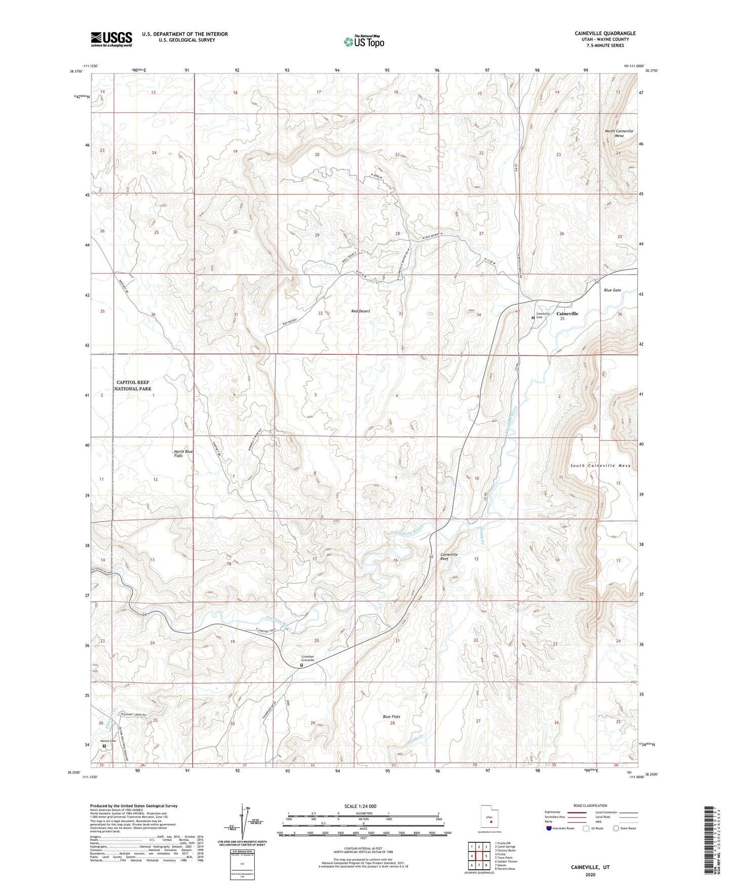
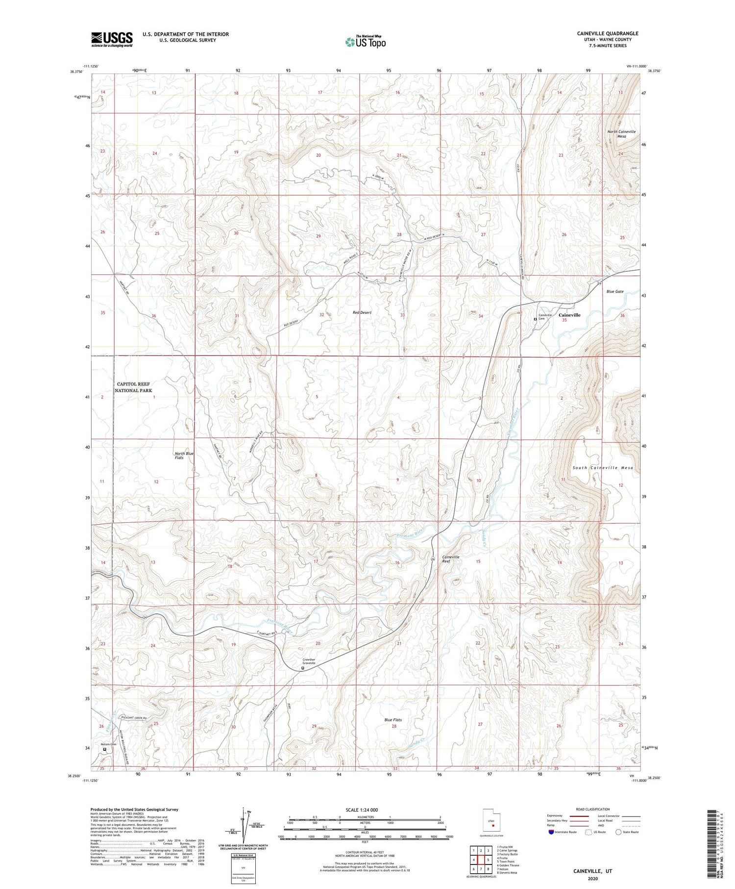
2020 topographic map quadrangle Caineville in the state of Utah. Scale: 1:24000. Based on the newly updated USGS 7.5' US Topo map series, this map is in the following counties: Wayne. The map contains contour data, water features, and other items you are used to seeing on USGS maps, but also has updated roads and other features. This is the next generation of topographic maps. Printed on high-quality waterproof paper with UV fade-resistant inks.
Quads adjacent to this one:
West: Fruita
Northwest: Fruita NW
North: Caine Springs
Northeast: Factory Butte
East: Town Point
Southeast: Stevens Mesa
South: Notom
Southwest: Golden Throne
Contains the following named places: Aldrich, Blue Flats, Caineville, Caineville Cemetery, Caineville Reef, Caineville Wash, Crowther Gravesite, North Blue Flats, Notom Cemetery, Pleasant Creek, Red Desert, River Ford, Sandy Creek