MyTopo
Notom Utah US Topo Map
Couldn't load pickup availability
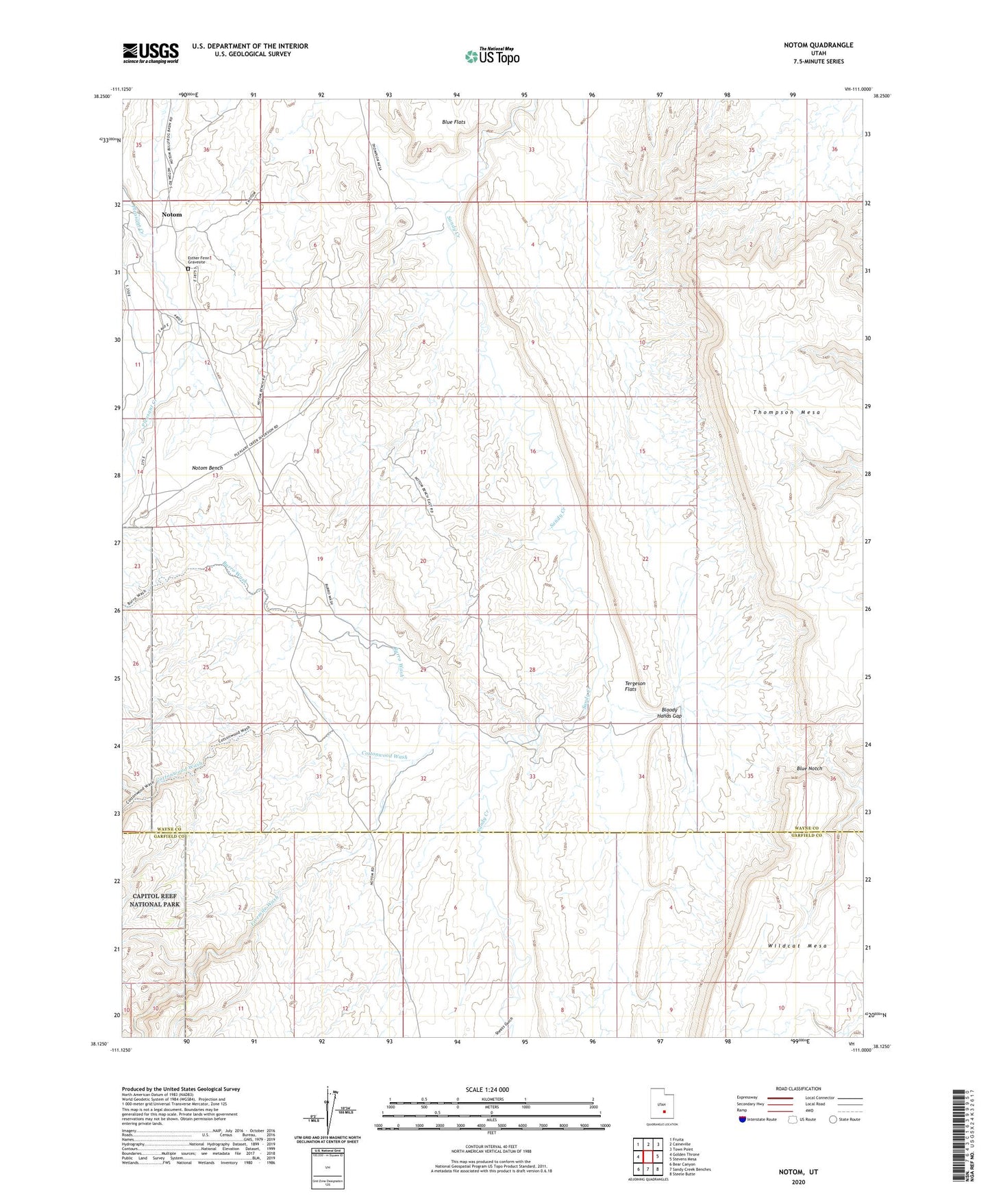
2023 topographic map quadrangle Notom in the state of Utah. Scale: 1:24000. Based on the newly updated USGS 7.5' US Topo map series, this map is in the following counties: Wayne, Garfield. The map contains contour data, water features, and other items you are used to seeing on USGS maps, but also has updated roads and other features. This is the next generation of topographic maps. Printed on high-quality waterproof paper with UV fade-resistant inks.
Quads adjacent to this one:
West: Golden Throne
Northwest: Fruita
North: Caineville
Northeast: Town Point
East: Stevens Mesa
Southeast: Steele Butte
South: Sandy Creek Benches
Southwest: Bear Canyon
This map covers the same area as the classic USGS quad with code o38111b1.
Contains the following named places: Blind Trail Wash, Bloody Hands Gap, Blue Notch, Burro Wash, Cottonwood Wash, Esther Fenn Gravesite, Fivemile Wash, Notom, Notom Bench, Sheets Gulch, Tergeson Flats, Thompson Mesa