MyTopo
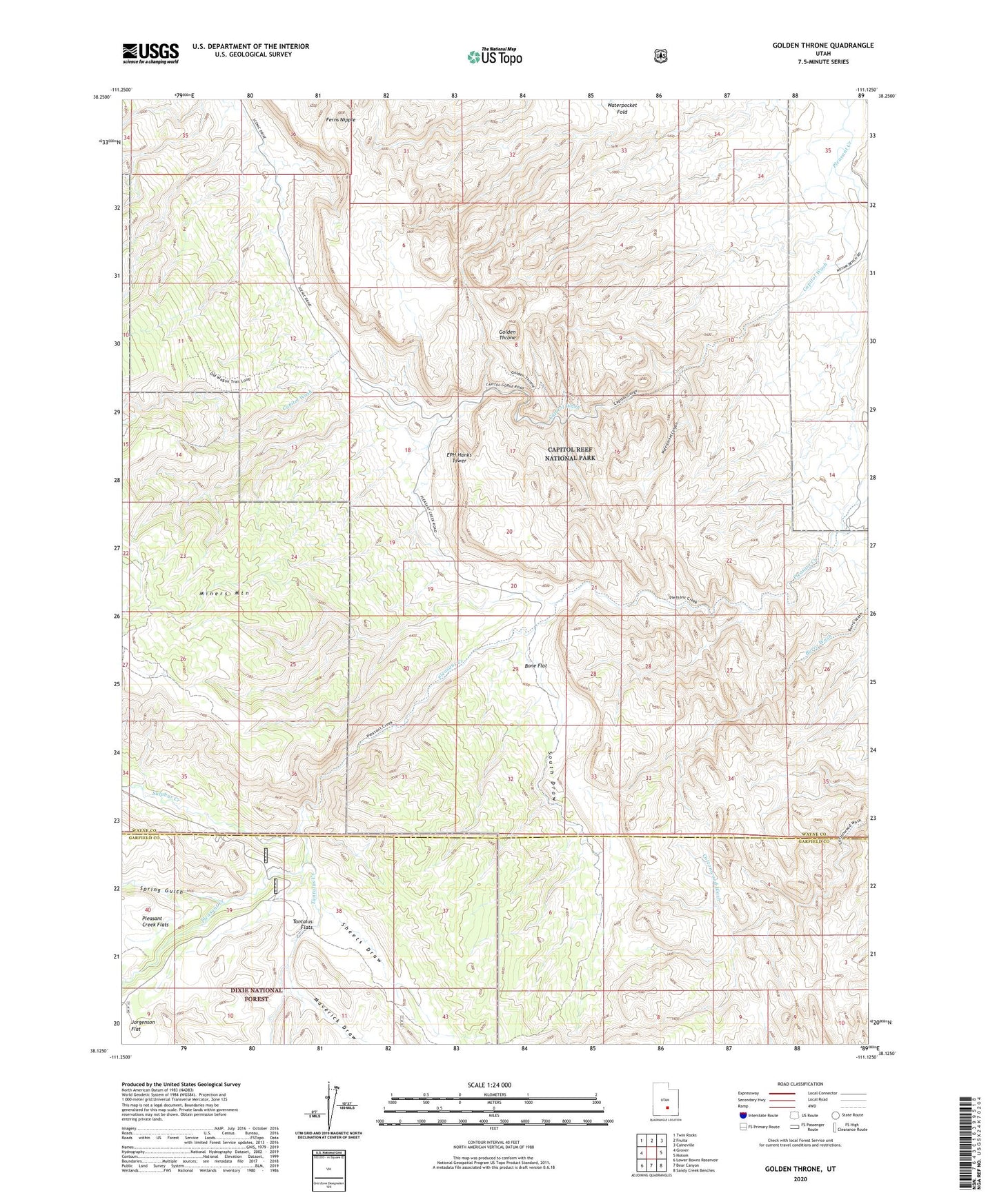
Golden Throne Utah US Topo Map
Couldn't load pickup availability
Also explore the Golden Throne Forest Service Topo of this same quad for updated USFS data
2023 topographic map quadrangle Golden Throne in the state of Utah. Scale: 1:24000. Based on the newly updated USGS 7.5' US Topo map series, this map is in the following counties: Wayne, Garfield. The map contains contour data, water features, and other items you are used to seeing on USGS maps, but also has updated roads and other features. This is the next generation of topographic maps. Printed on high-quality waterproof paper with UV fade-resistant inks.
Quads adjacent to this one:
West: Grover
Northwest: Twin Rocks
North: Fruita
Northeast: Caineville
East: Notom
Southeast: Sandy Creek Benches
South: Bear Canyon
Southwest: Lower Bowns Reservoir
This map covers the same area as the classic USGS quad with code o38111b2.
Contains the following named places: Bone Flat, Capitol Reef Campground, Capitol Reef National Park, Capitol Wash, EPH Hanks Tower, Ferns Nipple, Golden Throne, Maverick Draw, Pioneer Register, Pleasant Creek Ranch, Sheets Draw, South Draw, Spring Gulch, Sulphur Creek, Tantalus Creek, Tantalus Flats, Waterpocket Canyon, Waterpocket Fold